Herschdorf geodata
Herschdorf (Thuringia) is a seat of a fourth-order administrative division; located in Germany in Europe/Berlin (GMT+2) time zone. In our database, there are 11009 cities with bigger population. Compared to other cities in Germany, 50.2% of cities are located further ↓South; 67.7% of cities are located further ←West and 96.2% of cities have lower elevation than Herschdorf. Note1


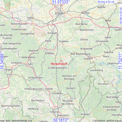
Herschdorf GPS coordinates[2]
50° 37' 45.948" North, 11° 2' 56.328" East
| Map corner | latitude | longitude |
|---|---|---|
| Upper-left | 51.07333°, | 10.34586° |
| Center: | 50.62943°, | 11.04898° |
| Lower-right: | 50.1813°, | 11.75211° |
| Map W x H: | 99.2×99.2 km | = 61.6×61.6mi |
| max Lat: | 55.01917° ⇑49.8% North |
| Herschdorf: | 50.62943° |
| min Lat: | ⇓50.2% South 47.40724° |
| min Long | Herschdorf | max Long |
| 5.92978° | 11.04898° | 14.98853° |
| W 67.7%⇐ | ⇒32.3% E |
Elevation
Elevation of Herschdorf is 634 m = 2080 ft, and this is 384.9 m = 1263 ft above average elevation for this country.
| Max E: |
1256 m = 4121 ft | 3.8% |
| Herschdorf | 634 m 2080 ft | |
| Avg. | 249.1 m = 817 ft | |
Min E: |
-5 m = -16 ft | 96.2% |
See also: Germany elevation on elevation.city.
Geographical zone
Herschdorf is located in North temperate zone (between Tropic of Cancer and the Arctic Circle). Distance of this North polar circle is 1771.7 km =1100.9 mi to North.| Distance of | km | miles | from Herschdorf |
|---|---|---|---|
| North Pole | 4377.6 | 2720.1 | to North |
| Arctic Circle | 1771.7 | 1100.9 | to North |
| Tropic Cancer | 3023.5 | 1878.7 | to South |
| Equator | 5629.5 | 3498 | to South |


Nearby cities:
15 places around Herschdorf: (largest is in red/bold)
• Allendorf
8.2 km =5.1 mi,  69°
69°
• Böhlen
4.6 km =2.9 mi,  184°
184°
• Dröbischau
1.7 km =1.1 mi,  88°
88°
• Friedersdorf
2.9 km =1.8 mi,  198°
198°
• Gehren
3.8 km =2.4 mi,  304°
304°
• Gillersdorf
2.7 km =1.7 mi,  238°
238°
• Großbreitenbach
5.8 km =3.6 mi,  208°
208°
• Königsee
4.9 km =3 mi,  43°
43°
• Langewiesen
7.3 km =4.5 mi,  311°
311°
• Mellenbach-Glasbach
3.9 km =2.4 mi,  111°
111°
• Meuselbach
7.1 km =4.4 mi,  155°
155°
• Möhrenbach
3.8 km =2.4 mi,  259°
259°
• Oberhain
6 km =3.7 mi, 85°
• Pennewitz
3.3 km =2.1 mi,  5°
5°
• Wildenspring
3.5 km =2.2 mi, 159°
Sources, notices
• [Note1] Compared only with cities in Germany existing in our database
• [Src1] Map data: © OpenStreetMap contributors (CC-BY-SA)
• [Src2] Other city data from geonames.org with taken over terms of usage.
• [Src3] Geographical zone / Annual Mean Temperature by Robert A. Rohde @ Wikipedia
