Bartow geodata
Bartow (Mecklenburg-Vorpommern) is a populated place; located in Germany in Europe/Berlin (GMT+2) time zone. With population of 600 people, there are 8822 cities with bigger population in this country. Compared to other cities in Germany, 90.2% of cities are located further ↓South; 94.7% of cities are located further ←West and 87.3% of cities have higher elevation than Bartow. Note1
Administrative division(s):
- Level 1: Mecklenburg-Vorpommern
- Level 3: Mecklenburgische Seenplatte
- Level 4: Bartow


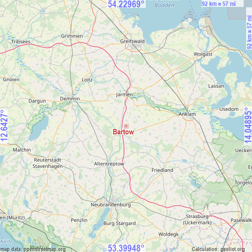
Bartow GPS coordinates[2]
53° 48' 59.904" North, 13° 20' 44.952" East
| Map corner | latitude | longitude |
|---|---|---|
| Upper-left | 54.22969°, | 12.6427° |
| Center: | 53.81664°, | 13.34582° |
| Lower-right: | 53.39948°, | 14.04895° |
| Map W x H: | 92.3×92.3 km | = 57.4×57.4mi |
| max Lat: | 55.01917° ⇑9.8% North |
| Bartow: | 53.81664° |
| min Lat: | ⇓90.2% South 47.40724° |
| min Long | Bartow | max Long |
| 5.92978° | 13.34582° | 14.98853° |
| W 94.7%⇐ | ⇒5.3% E |
Elevation
Elevation of Bartow is 29 m = 95 ft, and this is 220.1 m = 722 ft below average elevation for this country.
| Max E: |
1256 m = 4121 ft | 87.3% |
| Avg. | 249.1 m = 817 ft | |
| Bartow | 29 m = 95 ft | |
Min E: |
-5 m = -16 ft | 12.7% |
See also: Germany elevation on elevation.city.
Geographical zone
Bartow is located in North temperate zone (between Tropic of Cancer and the Arctic Circle). Distance of this North polar circle is 1417.3 km =880.7 mi to North.| Distance of | km | miles | from Bartow |
|---|---|---|---|
| North Pole | 4023.2 | 2499.9 | to North |
| Arctic Circle | 1417.3 | 880.7 | to North |
| Tropic Cancer | 3377.9 | 2098.9 | to South |
| Equator | 5983.8 | 3718.2 | to South |


Nearby cities:
15 places around Bartow: (largest is in red/bold)
• Alt Tellin
7.4 km =4.6 mi,  294°
294°
• Altentreptow
14.6 km =9.1 mi,  201°
201°
• Bentzin
15.2 km =9.4 mi,  341°
341°
• Burow
6.7 km =4.2 mi,  224°
224°
• Gültz
12.8 km =8 mi,  234°
234°
• Jarmen
11.9 km =7.4 mi,  358°
358°
• Kessin
10 km =6.2 mi,  194°
194°
• Krien
6.9 km =4.3 mi,  77°
77°
• Kruckow
11.7 km =7.3 mi,  323°
323°
• Neetzow
8.3 km =5.2 mi,  29°
29°
• Siedenbollentin
9.6 km =6 mi,  165°
165°
• Spantekow
12 km =7.5 mi,  111°
111°
• Tutow
12.7 km =7.9 mi,  329°
329°
• Völschow
6.8 km =4.2 mi,  354°
354°
• Ückeritz
15.8 km =9.8 mi, 318°
Sources, notices
• [Note1] Compared only with cities in Germany existing in our database
• [Src1] Map data: © OpenStreetMap contributors (CC-BY-SA)
• [Src2] Other city data from geonames.org with taken over terms of usage.
• [Src3] Geographical zone / Annual Mean Temperature by Robert A. Rohde @ Wikipedia
