Bandelin geodata
Bandelin (Mecklenburg-Vorpommern) is a populated place; located in Germany in Europe/Berlin (GMT+2) time zone. With population of 660 people, there are 8512 cities with bigger population in this country. Compared to other cities in Germany, 92.2% of cities are located further ↓South; 94.9% of cities are located further ←West and 88.9% of cities have higher elevation than Bandelin. Note1
Administrative division(s):
- Level 1: Mecklenburg-Vorpommern
- Level 3: Vorpommern-Greifswald
- Level 4: Bandelin


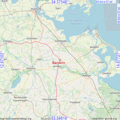
Bandelin GPS coordinates[2]
53° 57' 49.896" North, 13° 22' 26.904" East
| Map corner | latitude | longitude |
|---|---|---|
| Upper-left | 54.37546°, | 12.67102° |
| Center: | 53.96386°, | 13.37414° |
| Lower-right: | 53.54816°, | 14.07727° |
| Map W x H: | 92×92 km | = 57.2×57.2mi |
| max Lat: | 55.01917° ⇑7.8% North |
| Bandelin: | 53.96386° |
| min Lat: | ⇓92.2% South 47.40724° |
| min Long | Bandelin | max Long |
| 5.92978° | 13.37414° | 14.98853° |
| W 94.9%⇐ | ⇒5.1% E |
Elevation
Elevation of Bandelin is 24 m = 79 ft, and this is 225.1 m = 739 ft below average elevation for this country.
| Max E: |
1256 m = 4121 ft | 88.9% |
| Avg. | 249.1 m = 817 ft | |
| Bandelin | 24 m = 79 ft | |
Min E: |
-5 m = -16 ft | 11.1% |
See also: Germany elevation on elevation.city.
Geographical zone
Bandelin is located in North temperate zone (between Tropic of Cancer and the Arctic Circle). Distance of this North polar circle is 1401 km =870.5 mi to North.| Distance of | km | miles | from Bandelin |
|---|---|---|---|
| North Pole | 4006.8 | 2489.7 | to North |
| Arctic Circle | 1401 | 870.5 | to North |
| Tropic Cancer | 3394.3 | 2109.1 | to South |
| Equator | 6000.2 | 3728.4 | to South |


Nearby cities:
15 places around Bandelin: (largest is in red/bold)
• Behrenhoff
4.7 km =2.9 mi,  12°
12°
• Bentzin
6.9 km =4.3 mi,  253°
253°
• Dersekow
10.6 km =6.6 mi,  329°
329°
• Groß Kiesow
8.7 km =5.4 mi,  51°
51°
• Görmin
7.4 km =4.6 mi,  293°
293°
• Hinrichshagen Hof
12.3 km =7.6 mi,  352°
352°
• Jarmen
5 km =3.1 mi,  206°
206°
• Kruckow
11.2 km =7 mi,  231°
231°
• Neetzow
9.4 km =5.8 mi,  166°
166°
• Sassen
13.9 km =8.6 mi,  298°
298°
• Tutow
9.8 km =6.1 mi,  236°
236°
• Völschow
9.9 km =6.2 mi,  194°
194°
• Weitenhagen
10.3 km =6.4 mi, 13°
• Züssow
11.5 km =7.1 mi,  82°
82°
• Ückeritz
13.2 km =8.2 mi, 249°
Sources, notices
• [Note1] Compared only with cities in Germany existing in our database
• [Src1] Map data: © OpenStreetMap contributors (CC-BY-SA)
• [Src2] Other city data from geonames.org with taken over terms of usage.
• [Src3] Geographical zone / Annual Mean Temperature by Robert A. Rohde @ Wikipedia
