Ballenstedt geodata
Ballenstedt (Saxony-Anhalt) is a populated place; located in Germany in Europe/Berlin (GMT+2) time zone. With population of 8,064 people, there are 1946 cities with bigger population in this country. Compared to other cities in Germany, 69% of cities are located further ↓South; 70.4% of cities are located further ←West and 50.3% of cities have lower elevation than Ballenstedt. Note1


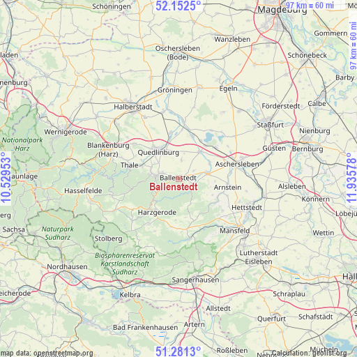
Ballenstedt GPS coordinates[2]
51° 43' 8.4" North, 11° 13' 57.54" East
| Map corner | latitude | longitude |
|---|---|---|
| Upper-left | 52.1525°, | 10.52953° |
| Center: | 51.719°, | 11.23265° |
| Lower-right: | 51.2813°, | 11.93578° |
| Map W x H: | 96.9×96.9 km | = 60.2×60.2mi |
| max Lat: | 55.01917° ⇑31% North |
| Ballenstedt: | 51.719° |
| min Lat: | ⇓69% South 47.40724° |
| min Long | Ballenstedt | max Long |
| 5.92978° | 11.23265° | 14.98853° |
| W 70.4%⇐ | ⇒29.6% E |
Elevation
Elevation of Ballenstedt is 228 m = 748 ft, and this is 21.1 m = 69 ft below average elevation for this country.
| Max E: |
1256 m = 4121 ft | 49.7% |
| Avg. | 249.1 m = 817 ft | |
| Ballenstedt | 228 m = 748 ft | |
Min E: |
-5 m = -16 ft | 50.3% |
See also: Germany elevation on elevation.city.
Geographical zone
Ballenstedt is located in North temperate zone (between Tropic of Cancer and the Arctic Circle). Distance of this North polar circle is 1650.6 km =1025.6 mi to North.| Distance of | km | miles | from Ballenstedt |
|---|---|---|---|
| North Pole | 4256.4 | 2644.8 | to North |
| Arctic Circle | 1650.6 | 1025.6 | to North |
| Tropic Cancer | 3144.7 | 1954 | to South |
| Equator | 5750.6 | 3573.3 | to South |


Nearby cities:
15 places around Ballenstedt: (largest is in red/bold)
• Alterode
11.5 km =7.1 mi,  114°
114°
• Bad Suderode
8.1 km =5 mi,  281°
281°
• Ditfurt
12.9 km =8 mi,  349°
349°
• Frose
13.2 km =8.2 mi,  49°
49°
• Gatersleben
12.1 km =7.5 mi,  17°
17°
• Gernrode
6.5 km =4 mi, 276°
• Harzgerode
10.6 km =6.6 mi,  215°
215°
• Hoym
9 km =5.6 mi,  37°
37°
• Nachterstedt
11.5 km =7.1 mi, 37°
• Neinstedt
10.6 km =6.6 mi,  288°
288°
• Quedlinburg
9.6 km =6 mi,  323°
323°
• Rieder
4.8 km =3 mi, 289°
• Schielo
11.1 km =6.9 mi,  184°
184°
• Stecklenberg
10.1 km =6.3 mi, 279°
• Weddersleben
11.4 km =7.1 mi,  296°
296°
Sources, notices
• [Note1] Compared only with cities in Germany existing in our database
• [Src1] Map data: © OpenStreetMap contributors (CC-BY-SA)
• [Src2] Other city data from geonames.org with taken over terms of usage.
• [Src3] Geographical zone / Annual Mean Temperature by Robert A. Rohde @ Wikipedia
