Adelsdorf geodata
Adelsdorf (Bavaria) is a seat of a fourth-order administrative division; located in Germany in Europe/Berlin (GMT+2) time zone. In our database, there are 11009 cities with bigger population. Compared to other cities in Germany, 71.1% of cities are located further ↑North; 65.4% of cities are located further ←West and 55.9% of cities have lower elevation than Adelsdorf. Note1
Administrative division(s):
- Level 1: Bavaria
- Level 2: Regierungsbezirk Mittelfranken
- Level 3: Landkreis Erlangen-Höchstadt
- Level 4: Adelsdorf


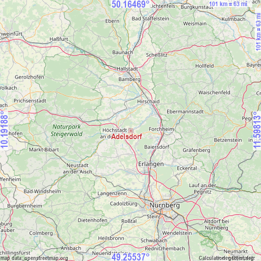
Adelsdorf GPS coordinates[2]
49° 42' 43.776" North, 10° 53' 42" East
| Map corner | latitude | longitude |
|---|---|---|
| Upper-left | 50.16469°, | 10.19188° |
| Center: | 49.71216°, | 10.895° |
| Lower-right: | 49.25537°, | 11.59813° |
| Map W x H: | 101.1×101.1 km | = 62.8×62.8mi |
| max Lat: | 55.01917° ⇑71.1% North |
| Adelsdorf: | 49.71216° |
| min Lat: | ⇓28.9% South 47.40724° |
| min Long | Adelsdorf | max Long |
| 5.92978° | 10.895° | 14.98853° |
| W 65.4%⇐ | ⇒34.6% E |
Elevation
Elevation of Adelsdorf is 265 m = 869 ft, and this is 15.9 m = 52 ft above average elevation for this country.
| Max E: |
1256 m = 4121 ft | 44.1% |
| Adelsdorf | 265 m 869 ft | |
| Avg. | 249.1 m = 817 ft | |
Min E: |
-5 m = -16 ft | 55.9% |
See also: Germany elevation on elevation.city.
Geographical zone
Adelsdorf is located in North temperate zone (between Tropic of Cancer and the Arctic Circle). Distance of this North polar circle is 1873.7 km =1164.3 mi to North.| Distance of | km | miles | from Adelsdorf |
|---|---|---|---|
| North Pole | 4479.6 | 2783.5 | to North |
| Arctic Circle | 1873.7 | 1164.3 | to North |
| Tropic Cancer | 2921.6 | 1815.4 | to South |
| Equator | 5527.5 | 3434.6 | to South |


Nearby cities:
15 places around Adelsdorf: (largest is in red/bold)
• Forchheim
11.8 km =7.3 mi,  87°
87°
• Gremsdorf
4.9 km =3 mi,  247°
247°
• Großenseebach
9 km =5.6 mi,  189°
189°
• Hallerndorf
8 km =5 mi,  49°
49°
• Hausen
10.2 km =6.3 mi,  104°
104°
• Hemhofen
4.2 km =2.6 mi,  139°
139°
• Heroldsbach
7.8 km =4.8 mi,  105°
105°
• Heßdorf
9.5 km =5.9 mi,  173°
173°
• Höchstadt an der Aisch
5.9 km =3.7 mi,  263°
263°
• Lonnerstadt
9.3 km =5.8 mi, 260°
• Möhrendorf
11.6 km =7.2 mi, 139°
• Mühlhausen
9.8 km =6.1 mi,  298°
298°
• Pommersfelden
8.3 km =5.2 mi,  317°
317°
• Röttenbach
5.8 km =3.6 mi,  157°
157°
• Weisendorf
11.1 km =6.9 mi,  206°
206°
Sources, notices
• [Note1] Compared only with cities in Germany existing in our database
• [Src1] Map data: © OpenStreetMap contributors (CC-BY-SA)
• [Src2] Other city data from geonames.org with taken over terms of usage.
• [Src3] Geographical zone / Annual Mean Temperature by Robert A. Rohde @ Wikipedia
