Mühlhausen geodata
Mühlhausen (Bavaria) is a populated place; located in Germany in Europe/Berlin (GMT+2) time zone. With population of 1,723 people, there are 5469 cities with bigger population in this country. Compared to other cities in Germany, 70% of cities are located further ↑North; 63.6% of cities are located further ←West and 57.8% of cities have lower elevation than Mühlhausen. Note1
Administrative division(s):
- Level 1: Bavaria
- Level 2: Regierungsbezirk Mittelfranken
- Level 3: Landkreis Erlangen-Höchstadt
- Level 4: Mühlhausen, Markt


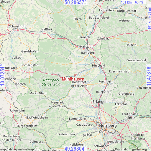
Mühlhausen GPS coordinates[2]
49° 45' 15.948" North, 10° 46' 32.268" East
| Map corner | latitude | longitude |
|---|---|---|
| Upper-left | 50.20657°, | 10.07251° |
| Center: | 49.75443°, | 10.77563° |
| Lower-right: | 49.29804°, | 11.47876° |
| Map W x H: | 101×101 km | = 62.8×62.8mi |
| max Lat: | 55.01917° ⇑70% North |
| Mühlhausen: | 49.75443° |
| min Lat: | ⇓30% South 47.40724° |
| min Long | Mühlhausen | max Long |
| 5.92978° | 10.77563° | 14.98853° |
| W 63.6%⇐ | ⇒36.4% E |
Elevation
Elevation of Mühlhausen is 277 m = 909 ft, and this is 27.9 m = 92 ft above average elevation for this country.
| Max E: |
1256 m = 4121 ft | 42.2% |
| Mühlhausen | 277 m 909 ft | |
| Avg. | 249.1 m = 817 ft | |
Min E: |
-5 m = -16 ft | 57.8% |
See also: Germany elevation on elevation.city.
Geographical zone
Mühlhausen is located in North temperate zone (between Tropic of Cancer and the Arctic Circle). Distance of this North polar circle is 1869 km =1161.3 mi to North.| Distance of | km | miles | from Mühlhausen |
|---|---|---|---|
| North Pole | 4474.9 | 2780.6 | to North |
| Arctic Circle | 1869 | 1161.3 | to North |
| Tropic Cancer | 2926.3 | 1818.3 | to South |
| Equator | 5532.2 | 3437.5 | to South |


Nearby cities:
15 places around Mühlhausen: (largest is in red/bold)
• Adelsdorf
9.8 km =6.1 mi,  118°
118°
• Burgebrach
8.5 km =5.3 mi,  344°
344°
• Burghaslach
12.8 km =8 mi,  259°
259°
• Frensdorf
9.5 km =5.9 mi,  43°
43°
• Gremsdorf
7.8 km =4.8 mi,  148°
148°
• Höchstadt an der Aisch
6 km =3.7 mi, 153°
• Lonnerstadt
6.2 km =3.9 mi,  185°
185°
• Pettstadt
13.8 km =8.6 mi,  52°
52°
• Pommersfelden
3.2 km =2 mi,  65°
65°
• Schlüsselfeld
11.3 km =7 mi,  271°
271°
• Stegaurach
13.3 km =8.3 mi,  21°
21°
• Uehlfeld
10.1 km =6.3 mi,  203°
203°
• Vestenbergsgreuth
11.6 km =7.2 mi,  230°
230°
• Wachenroth
4.5 km =2.8 mi, 266°
• Walsdorf
12.5 km =7.8 mi,  2°
2°
Sources, notices
• [Note1] Compared only with cities in Germany existing in our database
• [Src1] Map data: © OpenStreetMap contributors (CC-BY-SA)
• [Src2] Other city data from geonames.org with taken over terms of usage.
• [Src3] Geographical zone / Annual Mean Temperature by Robert A. Rohde @ Wikipedia
