Gremsdorf geodata
Gremsdorf (Bavaria) is a seat of a fourth-order administrative division; located in Germany in Europe/Berlin (GMT+2) time zone. With population of 1,541 people, there are 5793 cities with bigger population in this country. Compared to other cities in Germany, 71.6% of cities are located further ↑North; 64.5% of cities are located further ←West and 57.5% of cities have lower elevation than Gremsdorf. Note1
Administrative division(s):
- Level 1: Bavaria
- Level 2: Regierungsbezirk Mittelfranken
- Level 3: Landkreis Erlangen-Höchstadt
- Level 4: Gremsdorf


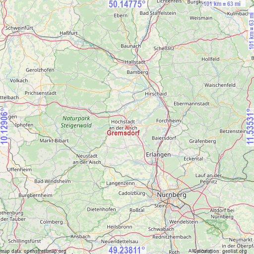
Gremsdorf GPS coordinates[2]
49° 41' 42.216" North, 10° 49' 55.848" East
| Map corner | latitude | longitude |
|---|---|---|
| Upper-left | 50.14775°, | 10.12906° |
| Center: | 49.69506°, | 10.83218° |
| Lower-right: | 49.23811°, | 11.53531° |
| Map W x H: | 101.1×101.1 km | = 62.8×62.8mi |
| max Lat: | 55.01917° ⇑71.6% North |
| Gremsdorf: | 49.69506° |
| min Lat: | ⇓28.4% South 47.40724° |
| min Long | Gremsdorf | max Long |
| 5.92978° | 10.83218° | 14.98853° |
| W 64.5%⇐ | ⇒35.5% E |
Elevation
Elevation of Gremsdorf is 275 m = 902 ft, and this is 25.9 m = 85 ft above average elevation for this country.
| Max E: |
1256 m = 4121 ft | 42.5% |
| Gremsdorf | 275 m 902 ft | |
| Avg. | 249.1 m = 817 ft | |
Min E: |
-5 m = -16 ft | 57.5% |
See also: Germany elevation on elevation.city.
Geographical zone
Gremsdorf is located in North temperate zone (between Tropic of Cancer and the Arctic Circle). Distance of this North polar circle is 1875.6 km =1165.4 mi to North.| Distance of | km | miles | from Gremsdorf |
|---|---|---|---|
| North Pole | 4481.5 | 2784.7 | to North |
| Arctic Circle | 1875.6 | 1165.4 | to North |
| Tropic Cancer | 2919.7 | 1814.2 | to South |
| Equator | 5525.6 | 3433.4 | to South |


Nearby cities:
15 places around Gremsdorf: (largest is in red/bold)
• Adelsdorf
4.9 km =3 mi,  67°
67°
• Gerhardshofen
12.4 km =7.7 mi,  235°
235°
• Großenseebach
7.6 km =4.7 mi,  156°
156°
• Hemhofen
7.4 km =4.6 mi,  100°
100°
• Heroldsbach
12 km =7.5 mi,  90°
90°
• Heßdorf
9.4 km =5.8 mi,  143°
143°
• Höchstadt an der Aisch
1.8 km =1.1 mi,  312°
312°
• Lonnerstadt
4.7 km =2.9 mi,  275°
275°
• Mühlhausen
7.8 km =4.8 mi,  328°
328°
• Oberreichenbach
12.6 km =7.8 mi,  201°
201°
• Pommersfelden
8 km =5 mi,  352°
352°
• Röttenbach
7.6 km =4.7 mi,  116°
116°
• Uehlfeld
8.5 km =5.3 mi,  251°
251°
• Wachenroth
10.6 km =6.6 mi, 306°
• Weisendorf
8 km =5 mi,  183°
183°
Sources, notices
• [Note1] Compared only with cities in Germany existing in our database
• [Src1] Map data: © OpenStreetMap contributors (CC-BY-SA)
• [Src2] Other city data from geonames.org with taken over terms of usage.
• [Src3] Geographical zone / Annual Mean Temperature by Robert A. Rohde @ Wikipedia
