Heckenbach geodata
Heckenbach (Rheinland-Pfalz) is a seat of a fourth-order administrative division; located in Germany in Europe/Berlin (GMT+2) time zone. With population of 247 people, there are 10270 cities with bigger population in this country. Compared to other cities in Germany, 53.5% of cities are located further ↑North; 92.8% of cities are located further →East and 88.1% of cities have lower elevation than Heckenbach. Note1
Administrative division(s):
- Level 1: Rheinland-Pfalz
- Level 3: Landkreis Ahrweiler
- Level 4: Heckenbach


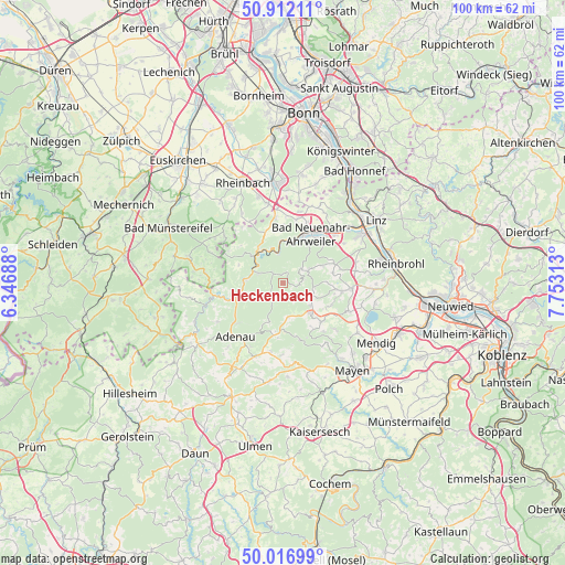
Heckenbach GPS coordinates[2]
50° 28' 0.012" North, 7° 3' 0" East
| Map corner | latitude | longitude |
|---|---|---|
| Upper-left | 50.91211°, | 6.34688° |
| Center: | 50.46667°, | 7.05° |
| Lower-right: | 50.01699°, | 7.75313° |
| Map W x H: | 99.5×99.5 km | = 61.8×61.8mi |
| max Lat: | 55.01917° ⇑53.5% North |
| Heckenbach: | 50.46667° |
| min Lat: | ⇓46.5% South 47.40724° |
| min Long | Heckenbach | max Long |
| 5.92978° | 7.05° | 14.98853° |
| W 7.2%⇐ | ⇒92.8% E |
Elevation
Elevation of Heckenbach is 494 m = 1621 ft, and this is 244.9 m = 803 ft above average elevation for this country.
| Max E: |
1256 m = 4121 ft | 11.9% |
| Heckenbach | 494 m 1621 ft | |
| Avg. | 249.1 m = 817 ft | |
Min E: |
-5 m = -16 ft | 88.1% |
See also: Germany elevation on elevation.city.
Geographical zone
Heckenbach is located in North temperate zone (between Tropic of Cancer and the Arctic Circle). Distance of this North polar circle is 1789.8 km =1112.1 mi to North.| Distance of | km | miles | from Heckenbach |
|---|---|---|---|
| North Pole | 4395.7 | 2731.4 | to North |
| Arctic Circle | 1789.8 | 1112.1 | to North |
| Tropic Cancer | 3005.4 | 1867.5 | to South |
| Equator | 5611.4 | 3486.8 | to South |


Nearby cities:
15 places around Heckenbach: (largest is in red/bold)
• Ahrbrück
4.7 km =2.9 mi,  291°
291°
• Altenahr
6.9 km =4.3 mi,  323°
323°
• Dernau
7.4 km =4.6 mi,  0°
0°
• Dümpelfeld
8 km =5 mi,  242°
242°
• Hausten
8.8 km =5.5 mi,  147°
147°
• Hohenleimbach
5.7 km =3.5 mi,  168°
168°
• Hönningen
7.1 km =4.4 mi,  270°
270°
• Kaltenborn
7.8 km =4.8 mi,  197°
197°
• Kempenich
7 km =4.3 mi,  137°
137°
• Kesseling
3 km =1.9 mi,  308°
308°
• Mayschoß
6.5 km =4 mi,  338°
338°
• Oberdürenbach
8.3 km =5.2 mi,  90°
90°
• Rech
5.7 km =3.5 mi,  348°
348°
• Schalkenbach
7.5 km =4.7 mi,  65°
65°
• Spessart
5.2 km =3.2 mi,  124°
124°
Sources, notices
• [Note1] Compared only with cities in Germany existing in our database
• [Src1] Map data: © OpenStreetMap contributors (CC-BY-SA)
• [Src2] Other city data from geonames.org with taken over terms of usage.
• [Src3] Geographical zone / Annual Mean Temperature by Robert A. Rohde @ Wikipedia
