Katzwinkel geodata
Katzwinkel (Rheinland-Pfalz) is a populated place; located in Germany in Europe/Berlin (GMT+2) time zone. With population of 2,005 people, there are 5062 cities with bigger population in this country. Compared to other cities in Germany, 54.4% of cities are located further ↓South; 80.5% of cities are located further →East and 58.5% of cities have lower elevation than Katzwinkel. Note1
Administrative division(s):
- Level 1: Rheinland-Pfalz
- Level 3: Landkreis Altenkirchen
- Level 4: Katzwinkel (Sieg)


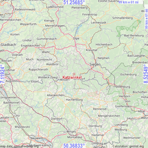
Katzwinkel GPS coordinates[2]
50° 48' 52.92" North, 7° 49' 20.496" East
| Map corner | latitude | longitude |
|---|---|---|
| Upper-left | 51.25685°, | 7.11924° |
| Center: | 50.8147°, | 7.82236° |
| Lower-right: | 50.36833°, | 8.52549° |
| Map W x H: | 98.8×98.8 km | = 61.4×61.4mi |
| max Lat: | 55.01917° ⇑45.6% North |
| Katzwinkel: | 50.8147° |
| min Lat: | ⇓54.4% South 47.40724° |
| min Long | Katzwinkel | max Long |
| 5.92978° | 7.82236° | 14.98853° |
| W 19.5%⇐ | ⇒80.5% E |
Elevation
Elevation of Katzwinkel is 281 m = 922 ft, and this is 31.9 m = 105 ft above average elevation for this country.
| Max E: |
1256 m = 4121 ft | 41.5% |
| Katzwinkel | 281 m 922 ft | |
| Avg. | 249.1 m = 817 ft | |
Min E: |
-5 m = -16 ft | 58.5% |
See also: Germany elevation on elevation.city.
Geographical zone
Katzwinkel is located in North temperate zone (between Tropic of Cancer and the Arctic Circle). Distance of this North polar circle is 1751.1 km =1088.1 mi to North.| Distance of | km | miles | from Katzwinkel |
|---|---|---|---|
| North Pole | 4357 | 2707.3 | to North |
| Arctic Circle | 1751.1 | 1088.1 | to North |
| Tropic Cancer | 3044.1 | 1891.5 | to South |
| Equator | 5650.1 | 3510.8 | to South |


Nearby cities:
15 places around Katzwinkel: (largest is in red/bold)
• Alsdorf
6.1 km =3.8 mi,  133°
133°
• Betzdorf
4.4 km =2.7 mi, 127°
• Birken-Honigsessen
6.3 km =3.9 mi,  272°
272°
• Elben
7.2 km =4.5 mi,  173°
173°
• Gebhardshain
7.2 km =4.5 mi,  183°
183°
• Grünebach
6.5 km =4 mi,  122°
122°
• Harbach
4 km =2.5 mi,  11°
11°
• Kirchen
4.5 km =2.8 mi,  98°
98°
• Mittelhof
4.6 km =2.9 mi,  195°
195°
• Molzhain
7.5 km =4.7 mi,  164°
164°
• Niederfischbach
5 km =3.1 mi,  38°
38°
• Scheuerfeld
3.3 km =2.1 mi, 156°
• Steineroth
6.4 km =4 mi, 159°
• Wallmenroth
1.8 km =1.1 mi,  154°
154°
• Wissen
7.3 km =4.5 mi,  237°
237°
Sources, notices
• [Note1] Compared only with cities in Germany existing in our database
• [Src1] Map data: © OpenStreetMap contributors (CC-BY-SA)
• [Src2] Other city data from geonames.org with taken over terms of usage.
• [Src3] Geographical zone / Annual Mean Temperature by Robert A. Rohde @ Wikipedia
