Ostseebad Kühlungsborn geodata
Ostseebad Kühlungsborn (Mecklenburg-Vorpommern) is a populated place; located in Germany in Europe/Berlin (GMT+2) time zone. With population of 7,453 people, there are 2083 cities with bigger population in this country. Compared to other cities in Germany, 94.5% of cities are located further ↓South; 78.2% of cities are located further ←West and 95.2% of cities have higher elevation than Ostseebad Kühlungsborn. Note1
Administrative division(s):
- Level 1: Mecklenburg-Vorpommern
- Level 3: Landkreis Rostock
- Level 4: Kühlungsborn
Current local time in Ostseebad Kühlungsborn:
06:22 AM, SaturdayDifference from your time zone: hours


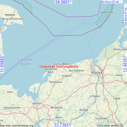
Ostseebad Kühlungsborn GPS coordinates[2]
54° 9' 1.26" North, 11° 45' 35.784" East
| Map corner | latitude | longitude |
|---|---|---|
| Upper-left | 54.5601°, | 11.05682° |
| Center: | 54.15035°, | 11.75994° |
| Lower-right: | 53.73651°, | 12.46307° |
| Map W x H: | 91.6×91.6 km | = 56.9×56.9mi |
| max Lat: | 55.01917° ⇑5.5% North |
| Ostseebad Kühlungsborn: | 54.15035° |
| min Lat: | ⇓94.5% South 47.40724° |
| min Long | Ostseebad Kühl | max Long |
| 5.92978° | 11.75994° | 14.98853° |
| W 78.2%⇐ | ⇒21.8% E |
Elevation
Elevation of Ostseebad Kühlungsborn is 8 m = 26 ft, and this is 241.1 m = 791 ft below average elevation for this country.
| Max E: |
1256 m = 4121 ft | 95.2% |
| Avg. | 249.1 m = 817 ft | |
| Ostseebad Kühlungsborn | 8 m = 26 ft | |
Min E: |
-5 m = -16 ft | 4.8% |
See also: Germany elevation on elevation.city.
Geographical zone
Ostseebad Kühlungsborn is located in North temperate zone (between Tropic of Cancer and the Arctic Circle). Distance of this North polar circle is 1380.2 km =857.6 mi to North.| Distance of | km | miles | from Ostseebad Kühlungsborn |
|---|---|---|---|
| North Pole | 3986.1 | 2476.8 | to North |
| Arctic Circle | 1380.2 | 857.6 | to North |
| Tropic Cancer | 3415 | 2122 | to South |
| Equator | 6021 | 3741.3 | to South |


Nearby cities:
15 places around Ostseebad Kühlungsborn: (largest is in red/bold)
• Admannshagen-Bargeshagen
15.7 km =9.8 mi,  98°
98°
• Bad Doberan
10.3 km =6.4 mi,  117°
117°
• Bartenshagen-Parkentin
16.2 km =10.1 mi, 118°
• Bastorf
4.9 km =3 mi,  236°
236°
• Biendorf
9.2 km =5.7 mi,  204°
204°
• Börgerende-Rethwisch
10.8 km =6.7 mi, 95°
• Elmenhorst
16.3 km =10.1 mi,  87°
87°
• Jennewitz
6.6 km =4.1 mi,  163°
163°
• Kröpelin
9.3 km =5.8 mi,  165°
165°
• Lambrechtshagen
17.6 km =10.9 mi,  107°
107°
• Neubukow
14.3 km =8.9 mi, 203°
• Reddelich
9 km =5.6 mi,  139°
139°
• Retschow
14 km =8.7 mi,  146°
146°
• Steffenshagen
6.5 km =4 mi, 141°
• Wittenbeck
3.6 km =2.2 mi, 149°
Sources, notices
• [Note1] Compared only with cities in Germany existing in our database
• [Src1] Map data: © OpenStreetMap contributors (CC-BY-SA)
• [Src2] Other city data from geonames.org with taken over terms of usage.
• [Src3] Geographical zone / Annual Mean Temperature by Robert A. Rohde @ Wikipedia
