Kröpelin geodata
Kröpelin (Mecklenburg-Vorpommern) is a populated place; located in Germany in Europe/Berlin (GMT+2) time zone. With population of 4,044 people, there are 3273 cities with bigger population in this country. Compared to other cities in Germany, 93.5% of cities are located further ↓South; 78.7% of cities are located further ←West and 74.7% of cities have higher elevation than Kröpelin. Note1
Administrative division(s):
- Level 1: Mecklenburg-Vorpommern
- Level 3: Landkreis Rostock
- Level 4: Kröpelin


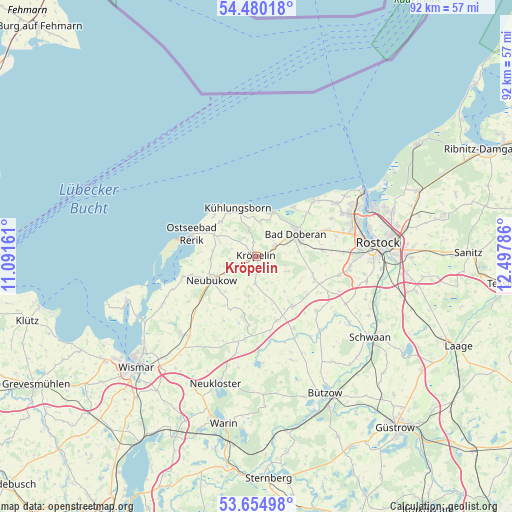
Kröpelin GPS coordinates[2]
54° 4' 10.668" North, 11° 47' 41.028" East
| Map corner | latitude | longitude |
|---|---|---|
| Upper-left | 54.48018°, | 11.09161° |
| Center: | 54.06963°, | 11.79473° |
| Lower-right: | 53.65498°, | 12.49786° |
| Map W x H: | 91.8×91.8 km | = 57×57mi |
| max Lat: | 55.01917° ⇑6.5% North |
| Kröpelin: | 54.06963° |
| min Lat: | ⇓93.5% South 47.40724° |
| min Long | Kröpelin | max Long |
| 5.92978° | 11.79473° | 14.98853° |
| W 78.7%⇐ | ⇒21.3% E |
Elevation
Elevation of Kröpelin is 64 m = 210 ft, and this is 185.1 m = 607 ft below average elevation for this country.
| Max E: |
1256 m = 4121 ft | 74.7% |
| Avg. | 249.1 m = 817 ft | |
| Kröpelin | 64 m = 210 ft | |
Min E: |
-5 m = -16 ft | 25.3% |
See also: Germany elevation on elevation.city.
Geographical zone
Kröpelin is located in North temperate zone (between Tropic of Cancer and the Arctic Circle). Distance of this North polar circle is 1389.2 km =863.2 mi to North.| Distance of | km | miles | from Kröpelin |
|---|---|---|---|
| North Pole | 3995.1 | 2482.4 | to North |
| Arctic Circle | 1389.2 | 863.2 | to North |
| Tropic Cancer | 3406.1 | 2116.5 | to South |
| Equator | 6012 | 3735.7 | to South |


Nearby cities:
15 places around Kröpelin: (largest is in red/bold)
• Bad Doberan
8.1 km =5 mi,  58°
58°
• Bartenshagen-Parkentin
12.1 km =7.5 mi,  83°
83°
• Bastorf
8.9 km =5.5 mi,  314°
314°
• Biendorf
6.1 km =3.8 mi,  275°
275°
• Börgerende-Rethwisch
11.7 km =7.3 mi,  46°
46°
• Heiligenhagen
11.3 km =7 mi,  126°
126°
• Jennewitz
2.7 km =1.7 mi,  352°
352°
• Jürgenshagen
14.5 km =9 mi,  152°
152°
• Neubukow
8.9 km =5.5 mi,  241°
241°
• Ostseebad Kühlungsborn
9.3 km =5.8 mi, 345°
• Reddelich
4.2 km =2.6 mi, 59°
• Retschow
6 km =3.7 mi,  116°
116°
• Satow-Oberhagen
10.1 km =6.3 mi,  144°
144°
• Steffenshagen
4.3 km =2.7 mi,  24°
24°
• Wittenbeck
5.9 km =3.7 mi,  355°
355°
Sources, notices
• [Note1] Compared only with cities in Germany existing in our database
• [Src1] Map data: © OpenStreetMap contributors (CC-BY-SA)
• [Src2] Other city data from geonames.org with taken over terms of usage.
• [Src3] Geographical zone / Annual Mean Temperature by Robert A. Rohde @ Wikipedia
