Stuttgart-Ost geodata
Stuttgart-Ost (Baden-Württemberg) is a section of populated place; located in Germany in Europe/Berlin (GMT+2) time zone. With population of 47,500 people, there are 243 cities with bigger population in this country. Compared to other cities in Germany, 85.5% of cities are located further ↑North; 62.2% of cities are located further →East and 55.2% of cities have lower elevation than Stuttgart-Ost. Note1
Administrative division(s):
- Level 1: Baden-Württemberg
- Level 2: Regierungsbezirk Stuttgart
- Level 3: Stadtkreis Stuttgart
- Level 4: Stuttgart


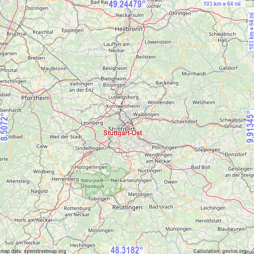
Stuttgart-Ost GPS coordinates[2]
48° 47' 1.068" North, 9° 12' 37.152" East
| Map corner | latitude | longitude |
|---|---|---|
| Upper-left | 49.24479°, | 8.5072° |
| Center: | 48.78363°, | 9.21032° |
| Lower-right: | 48.3182°, | 9.91345° |
| Map W x H: | 103×103 km | = 64×64mi |
| max Lat: | 55.01917° ⇑85.5% North |
| Stuttgart-Ost: | 48.78363° |
| min Lat: | ⇓14.5% South 47.40724° |
| min Long | Stuttgart-Ost | max Long |
| 5.92978° | 9.21032° | 14.98853° |
| W 37.8%⇐ | ⇒62.2% E |
Elevation
Elevation of Stuttgart-Ost is 259 m = 850 ft, and this is 9.9 m = 32 ft above average elevation for this country.
| Max E: |
1256 m = 4121 ft | 44.8% |
| Stuttgart-Ost | 259 m 850 ft | |
| Avg. | 249.1 m = 817 ft | |
Min E: |
-5 m = -16 ft | 55.2% |
See also: Stuttgart-Ost elevation on elevation.city.
Geographical zone
Stuttgart-Ost is located in North temperate zone (between Tropic of Cancer and the Arctic Circle). Distance of this North polar circle is 1976.9 km =1228.4 mi to North.| Distance of | km | miles | from Stuttgart-Ost |
|---|---|---|---|
| North Pole | 4582.8 | 2847.6 | to North |
| Arctic Circle | 1976.9 | 1228.4 | to North |
| Tropic Cancer | 2818.3 | 1751.2 | to South |
| Equator | 5424.2 | 3370.4 | to South |


Nearby cities:
15 places around Stuttgart-Ost: (largest is in red/bold)
• Denkendorf
12.5 km =7.8 mi,  141°
141°
• Ditzingen
11.5 km =7.1 mi,  294°
294°
• Esslingen
8.5 km =5.3 mi,  125°
125°
• Fellbach
5.6 km =3.5 mi,  59°
59°
• Gerlingen
10.9 km =6.8 mi,  279°
279°
• Korntal
8.5 km =5.3 mi,  309°
309°
• Kornwestheim
8.9 km =5.5 mi,  348°
348°
• Leinfelden-Echterdingen
10.4 km =6.5 mi,  197°
197°
• Neuhausen auf den Fildern
12.4 km =7.7 mi,  154°
154°
• Ostfildern
6.9 km =4.3 mi,  155°
155°
• Stuttgart
2.4 km =1.5 mi,  266°
266°
• Stuttgart Feuerbach
4.8 km =3 mi, 305°
• Stuttgart Mühlhausen
6.7 km =4.2 mi,  12°
12°
• Waiblingen
9.5 km =5.9 mi, 55°
• Weinstadt-Endersbach
11.7 km =7.3 mi,  73°
73°
Sources, notices
• [Note1] Compared only with cities in Germany existing in our database
• [Src1] Map data: © OpenStreetMap contributors (CC-BY-SA)
• [Src2] Other city data from geonames.org with taken over terms of usage.
• [Src3] Geographical zone / Annual Mean Temperature by Robert A. Rohde @ Wikipedia
