Helsinge geodata
Helsinge (Capital Region) is a seat of a second-order administrative division; located in Denmark in Europe/Copenhagen (GMT+2) time zone. With population of 7,354 people, there are 99 cities with bigger population in this country. Compared to other cities in Denmark, 65.8% of cities are located further ↓South; 83.3% of cities are located further ←West and 63.2% of cities have lower elevation than Helsinge. Note1


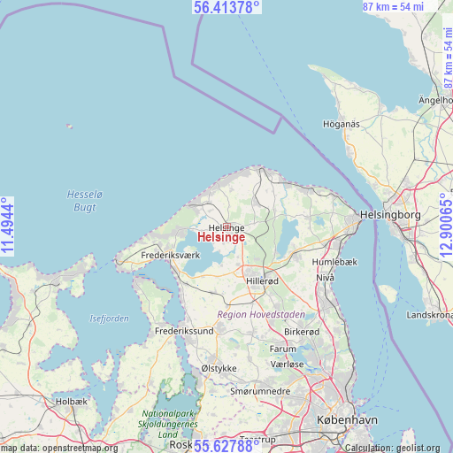
Helsinge GPS coordinates[2]
56° 1' 22.188" North, 12° 11' 51.072" East
| Map corner | latitude | longitude |
|---|---|---|
| Upper-left | 56.41378°, | 11.4944° |
| Center: | 56.02283°, | 12.19752° |
| Lower-right: | 55.62788°, | 12.90065° |
| Map W x H: | 87.4×87.4 km | = 54.3×54.3mi |
| max Lat: | 57.72093° ⇑34.2% North |
| Helsinge: | 56.02283° |
| min Lat: | ⇓65.8% South 54.57644° |
| min Long | Helsinge | max Long |
| 8.12605° | 12.19752° | 15.18662° |
| W 83.3%⇐ | ⇒16.7% E |
Elevation
Elevation of Helsinge is 31 m = 102 ft, and this is 3.7 m = 12 ft above average elevation for this country.
| Max E: |
114 m = 374 ft | 36.8% |
| Helsinge | 31 m 102 ft | |
| Avg. | 27.3 m = 90 ft | |
Min E: |
0 m = 0 ft | 63.2% |
See also: Denmark elevation on elevation.city.
Geographical zone
Helsinge is located in North temperate zone (between Tropic of Cancer and the Arctic Circle). Distance of this North polar circle is 1172 km =728.2 mi to North.| Distance of | km | miles | from Helsinge |
|---|---|---|---|
| North Pole | 3777.9 | 2347.5 | to North |
| Arctic Circle | 1172 | 728.2 | to North |
| Tropic Cancer | 3623.2 | 2251.4 | to South |
| Equator | 6229.2 | 3870.6 | to South |


Nearby cities:
15 places around Helsinge: (largest is in red/bold)
• Blovstrød
20.6 km =12.8 mi,  145°
145°
• Fredensborg
13.8 km =8.6 mi,  112°
112°
• Frederikssund
21.9 km =13.6 mi,  201°
201°
• Frederiksværk
12.3 km =7.6 mi,  241°
241°
• Gilleleje
13.1 km =8.1 mi,  32°
32°
• Græsted
7.2 km =4.5 mi,  48°
48°
• Hillerød
12.4 km =7.7 mi, 148°
• Hornbæk
17.8 km =11.1 mi,  65°
65°
• Lillerød
18.9 km =11.7 mi, 150°
• Liseleje
14.5 km =9 mi,  265°
265°
• Lynge
21 km =13 mi,  166°
166°
• Nivå
21.5 km =13.4 mi,  117°
117°
• Nødebo
10.5 km =6.5 mi, 117°
• Skævinge
13.1 km =8.1 mi,  192°
192°
• Slangerup
19.2 km =11.9 mi,  182°
182°
Sources, notices
• [Note1] Compared only with cities in Denmark existing in our database
• [Src1] Map data: © OpenStreetMap contributors (CC-BY-SA)
• [Src2] Other city data from geonames.org with taken over terms of usage.
• [Src3] Geographical zone / Annual Mean Temperature by Robert A. Rohde @ Wikipedia
