Jaibón geodata
Jaibón (Valverde) is a populated place; located in Dominican Republic in America/Santo_Domingo (GMT-4) time zone. With population of 4,853 people, there are 117 cities with bigger population in this country. Compared to other cities in Dominican Republic, 87.2% of cities are located further ↓South; 72% of cities are located further →East and 57.8% of cities have higher elevation than Jaibón. Note1
Administrative division(s):
- Level 1: Valverde
- Level 2: Mao
- Level 3: Jaibón (Pueblo Nuevo) (D. M.).
- Level 4: Pueblo Nuevo


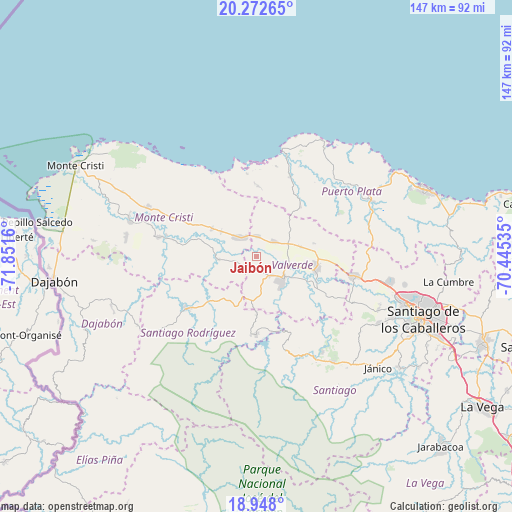
Jaibón GPS coordinates[2]
19° 36' 42.084" North, 71° 8' 54.492" West
| Map corner | latitude | longitude |
|---|---|---|
| Upper-left | 20.27265°, | -71.8516° |
| Center: | 19.61169°, | -71.14847° |
| Lower-right: | 18.948°, | -70.44535° |
| Map W x H: | 147.3×147.3 km | = 91.5×91.5mi |
| max Lat: | 19.89131° ⇑12.8% North |
| Jaibón: | 19.61169° |
| min Lat: | ⇓87.2% South 17.80136° |
| min Long | Jaibón | max Long |
| -71.85022° | -71.14847° | -68.40431° |
| W 28%⇐ | ⇒72% E |
Elevation
Elevation of Jaibón is 51 m = 167 ft, and this is 115.3 m = 378 ft below average elevation for this country.
| Max E: |
1242 m = 4075 ft | 57.8% |
| Avg. | 166.3 m = 546 ft | |
| Jaibón | 51 m = 167 ft | |
Min E: |
5 m = 16 ft | 42.2% |
See also: Dominican Republic elevation on elevation.city.
Geographical zone
Jaibón is located in North Torrid zone (between Equator and Tropic of Cancer). Distance of this Northern Tropic circle is 425.3 km =264.3 mi to North.| Distance of | km | miles | from Jaibón |
|---|---|---|---|
| North Pole | 7826.4 | 4863.1 | to North |
| Arctic Circle | 5220.6 | 3243.9 | to North |
| Tropic Cancer | 425.3 | 264.3 | to North |
| Equator | 2180.6 | 1355 | to South |


Nearby cities:
15 places around Jaibón: (largest is in red/bold)
• Amina
17.5 km =10.9 mi,  113°
113°
• Cana Chapetón
11.4 km =7.1 mi,  267°
267°
• Esperanza
17.4 km =10.8 mi,  99°
99°
• Estero Hondo
24.1 km =15 mi,  353°
353°
• Hatillo Palma
7.4 km =4.6 mi,  319°
319°
• Jicomé
21.3 km =13.2 mi,  78°
78°
• La Caya
10.2 km =6.3 mi,  16°
16°
• Laguna Salada
8 km =5 mi,  57°
57°
• Los Hidalgos
18.1 km =11.2 mi,  41°
41°
• Maizal
13 km =8.1 mi, 77°
• Mao
9.9 km =6.2 mi,  132°
132°
• Monción
22.3 km =13.9 mi,  181°
181°
• Sabaneta
25.1 km =15.6 mi,  233°
233°
• Villa Elisa
15.2 km =9.4 mi,  302°
302°
• Villa Isabela
24.5 km =15.2 mi, 22°
Sources, notices
• [Note1] Compared only with cities in Dominican Republic existing in our database
• [Src1] Map data: © OpenStreetMap contributors (CC-BY-SA)
• [Src2] Other city data from geonames.org with taken over terms of usage.
• [Src3] Geographical zone / Annual Mean Temperature by Robert A. Rohde @ Wikipedia
