Esperanza geodata
Esperanza (Valverde) is a populated place; located in Dominican Republic in America/Santo_Domingo (GMT-4) time zone. With population of 42,169 people, there are 24 cities with bigger population in this country. Compared to other cities in Dominican Republic, 85.8% of cities are located further ↓South; 65.4% of cities are located further →East and 62.1% of cities have lower elevation than Esperanza. Note1
Administrative division(s):
- Level 1: Valverde
- Level 2: Esperanza
- Level 3: Esperanza
- Level 4: Esperanza (Zona Urbana)


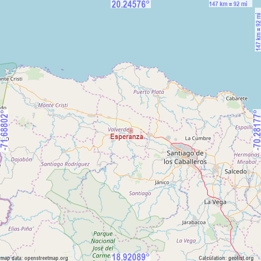
Esperanza GPS coordinates[2]
19° 35' 4.884" North, 70° 59' 5.604" West
| Map corner | latitude | longitude |
|---|---|---|
| Upper-left | 20.24576°, | -71.68802° |
| Center: | 19.58469°, | -70.98489° |
| Lower-right: | 18.92089°, | -70.28177° |
| Map W x H: | 147.3×147.3 km | = 91.5×91.5mi |
| max Lat: | 19.89131° ⇑14.2% North |
| Esperanza: | 19.58469° |
| min Lat: | ⇓85.8% South 17.80136° |
| min Long | Esperanza | max Long |
| -71.85022° | -70.98489° | -68.40431° |
| W 34.6%⇐ | ⇒65.4% E |
Elevation
Elevation of Esperanza is 113 m = 371 ft, and this is 53.3 m = 175 ft below average elevation for this country.
| Max E: |
1242 m = 4075 ft | 37.9% |
| Avg. | 166.3 m = 546 ft | |
| Esperanza | 113 m = 371 ft | |
Min E: |
5 m = 16 ft | 62.1% |
See also: Esperanza elevation on elevation.city.
Geographical zone
Esperanza is located in North Torrid zone (between Equator and Tropic of Cancer). Distance of this Northern Tropic circle is 428.3 km =266.1 mi to North.| Distance of | km | miles | from Esperanza |
|---|---|---|---|
| North Pole | 7829.4 | 4865 | to North |
| Arctic Circle | 5223.6 | 3245.8 | to North |
| Tropic Cancer | 428.3 | 266.1 | to North |
| Equator | 2177.6 | 1353.1 | to South |


Nearby cities:
15 places around Esperanza: (largest is in red/bold)
• Altamira
18 km =11.2 mi,  55°
55°
• Amina
4.2 km =2.6 mi,  195°
195°
• Guananico
17.1 km =10.6 mi,  22°
22°
• Guatapanal
11.2 km =7 mi,  140°
140°
• Hatillo Palma
23.6 km =14.7 mi,  291°
291°
• Jaibón
17.4 km =10.8 mi,  279°
279°
• Jicomé
8.1 km =5 mi,  27°
27°
• La Canela
21.6 km =13.4 mi,  125°
125°
• La Caya
19.1 km =11.9 mi,  311°
311°
• Laguna Salada
12.7 km =7.9 mi, 305°
• Los Hidalgos
17.3 km =10.7 mi,  342°
342°
• Maizal
7.3 km =4.5 mi,  322°
322°
• Mao
10.4 km =6.5 mi,  249°
249°
• Villa Bisonó
11.7 km =7.3 mi,  101°
101°
• Villa González
21.1 km =13.1 mi, 103°
Sources, notices
• [Note1] Compared only with cities in Dominican Republic existing in our database
• [Src1] Map data: © OpenStreetMap contributors (CC-BY-SA)
• [Src2] Other city data from geonames.org with taken over terms of usage.
• [Src3] Geographical zone / Annual Mean Temperature by Robert A. Rohde @ Wikipedia
