Timimoun geodata
Timimoun (Adrar) is a populated place; located in Algeria in Africa/Algiers (GMT+1) time zone. With population of 49,237 people, there are 102 cities with bigger population in this country. Compared to other cities in Algeria, 97.3% of cities are located further ↑North; 84.5% of cities are located further →East and 51.9% of cities have higher elevation than Timimoun. Note1


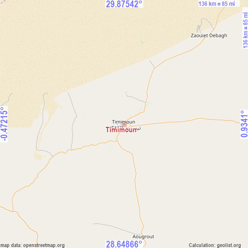
Timimoun GPS coordinates[2]
29° 15' 49.968" North, 0° 13' 51.528" East
| Map corner | latitude | longitude |
|---|---|---|
| Upper-left | 29.87542°, | -0.47215° |
| Center: | 29.26388°, | 0.23098° |
| Lower-right: | 28.64866°, | 0.9341° |
| Map W x H: | 136.4×136.4 km | = 84.8×84.8mi |
| max Lat: | 36.92917° ⇑97.3% North |
| Timimoun: | 29.26388° |
| min Lat: | ⇓2.7% South 22.785° |
| min Long | Timimoun | max Long |
| -8.14743° | 0.23098° | 8.46667° |
| W 15.5%⇐ | ⇒84.5% E |
Elevation
Elevation of Timimoun is 279 m = 915 ft, and this is 159.5 m = 523 ft below average elevation for this country.
| Max E: |
1392 m = 4567 ft | 51.9% |
| Avg. | 438.5 m = 1439 ft | |
| Timimoun | 279 m = 915 ft | |
Min E: |
5 m = 16 ft | 48.1% |
See also: Timimoun elevation on elevation.city.
Geographical zone
Timimoun is located in North temperate zone (between Tropic of Cancer and the Arctic Circle). Distance of this Northern Tropic circle is 647.9 km =402.6 mi to South.| Distance of | km | miles | from Timimoun |
|---|---|---|---|
| North Pole | 6753.2 | 4196.2 | to North |
| Arctic Circle | 4147.3 | 2577 | to North |
| Tropic Cancer | 647.9 | 402.6 | to South |
| Equator | 3253.8 | 2021.8 | to South |


Nearby cities:
8 places around Timimoun: (largest is in red/bold)
• Adrar
162.8 km =101.2 mi,  198°
198°
• Aoulef
268.8 km =167 mi,  161°
161°
• Aïn Sefra
395.3 km =245.6 mi,  348°
348°
• Brezina
437.5 km =271.8 mi,  12°
12°
• Béchar
351.4 km =218.3 mi,  318°
318°
• El Abiodh Sidi Cheikh
404.7 km =251.5 mi,  4°
4°
• I-n-Salah
317.3 km =197.2 mi,  136°
136°
• Reggane
283.4 km =176.1 mi,  181°
181°
Sources, notices
• [Note1] Compared only with cities in Algeria existing in our database
• [Src1] Map data: © OpenStreetMap contributors (CC-BY-SA)
• [Src2] Other city data from geonames.org with taken over terms of usage.
• [Src3] Geographical zone / Annual Mean Temperature by Robert A. Rohde @ Wikipedia
