Aïn Sefra geodata
Aïn Sefra (Naama) is a populated place; located in Algeria in Africa/Algiers (GMT+1) time zone. With population of 63,420 people, there are 71 cities with bigger population in this country. Compared to other cities in Algeria, 94.2% of cities are located further ↑North; 90.3% of cities are located further →East and 93% of cities have lower elevation than Aïn Sefra. Note1


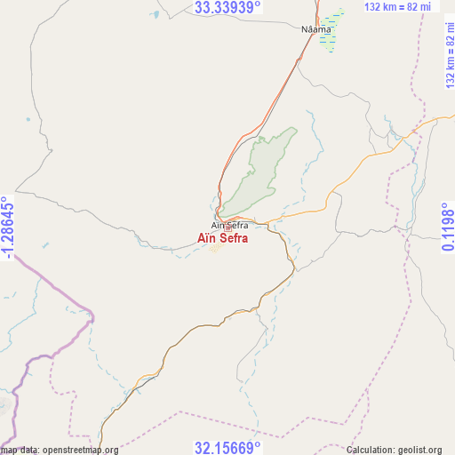
Aïn Sefra GPS coordinates[2]
32° 45' 0" North, 0° 34' 59.988" West
| Map corner | latitude | longitude |
|---|---|---|
| Upper-left | 33.33939°, | -1.28645° |
| Center: | 32.75°, | -0.58333° |
| Lower-right: | 32.15669°, | 0.1198° |
| Map W x H: | 131.5×131.5 km | = 81.7×81.7mi |
| max Lat: | 36.92917° ⇑94.2% North |
| Aïn Sefra: | 32.75° |
| min Lat: | ⇓5.8% South 22.785° |
| min Long | Aïn Sefra | max Long |
| -8.14743° | -0.58333° | 8.46667° |
| W 9.7%⇐ | ⇒90.3% E |
Elevation
Elevation of Aïn Sefra is 1078 m = 3537 ft, and this is 639.5 m = 2098 ft above average elevation for this country.
| Max E: |
1392 m = 4567 ft | 7% |
| Aïn Sefra | 1078 m 3537 ft | |
| Avg. | 438.5 m = 1439 ft | |
Min E: |
5 m = 16 ft | 93% |
See also: Aïn Sefra elevation on elevation.city.
Geographical zone
Aïn Sefra is located in North temperate zone (between Tropic of Cancer and the Arctic Circle). Distance of this Northern Tropic circle is 1035.5 km =643.4 mi to South.| Distance of | km | miles | from Aïn Sefra |
|---|---|---|---|
| North Pole | 6365.6 | 3955.4 | to North |
| Arctic Circle | 3759.7 | 2336.2 | to North |
| Tropic Cancer | 1035.5 | 643.4 | to South |
| Equator | 3641.5 | 2262.7 | to South |


Nearby cities:
15 places around Aïn Sefra: (largest is in red/bold)
• Beni Mester
248.2 km =154.2 mi,  341°
341°
• Brezina
176.4 km =109.6 mi,  77°
77°
• Béchar
198.8 km =123.5 mi,  230°
230°
• Chetouane
250.2 km =155.5 mi, 344°
• El Abiodh Sidi Cheikh
106.9 km =66.4 mi, 81°
• El Bayadh
181.6 km =112.8 mi,  55°
55°
• Hennaya
255.3 km =158.6 mi, 343°
• Mansoûra
245 km =152.2 mi, 343°
• Naama
62.6 km =38.9 mi,  23°
23°
• Ouled Mimoun
243.2 km =151.1 mi,  350°
350°
• Saïda
241.1 km =149.8 mi, 16°
• Sebdou
220.9 km =137.3 mi, 341°
• Sidi Senoussi سيدي سنوسي
254.2 km =158 mi, 349°
• Tlemcen
246.1 km =152.9 mi, 344°
• ’Aïn el Hadjar
233.3 km =145 mi, 16°
Sources, notices
• [Note1] Compared only with cities in Algeria existing in our database
• [Src1] Map data: © OpenStreetMap contributors (CC-BY-SA)
• [Src2] Other city data from geonames.org with taken over terms of usage.
• [Src3] Geographical zone / Annual Mean Temperature by Robert A. Rohde @ Wikipedia
