Tapa geodata
Tapa (Lääne-Virumaa) is a seat of a second-order administrative division; located in Estonia in Europe/Tallinn (GMT+3) time zone. With population of 6,551 people, there are 17 cities with bigger population in this country. Compared to other cities in Estonia, 68.4% of cities are located further ↓South; 59.5% of cities are located further ←West and 94.2% of cities have lower elevation than Tapa. Note1


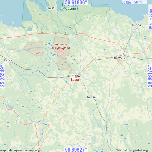
Tapa GPS coordinates[2]
59° 15' 38.016" North, 25° 57' 30.996" East
| Map corner | latitude | longitude |
|---|---|---|
| Upper-left | 59.61806°, | 25.25549° |
| Center: | 59.26056°, | 25.95861° |
| Lower-right: | 58.89927°, | 26.66174° |
| Map W x H: | 79.9×79.9 km | = 49.6×49.6mi |
| max Lat: | 59.57639° ⇑31.6% North |
| Tapa: | 59.26056° |
| min Lat: | ⇓68.4% South 57.72778° |
| min Long | Tapa | max Long |
| 22.24646° | 25.95861° | 28.19028° |
| W 59.5%⇐ | ⇒40.5% E |
Elevation
Elevation of Tapa is 103 m = 338 ft, and this is 49.8 m = 163 ft above average elevation for this country.
| Max E: |
141 m = 463 ft | 5.8% |
| Tapa | 103 m 338 ft | |
| Avg. | 53.2 m = 175 ft | |
Min E: |
6 m = 20 ft | 94.2% |
See also: Estonia elevation on elevation.city.
Geographical zone
Tapa is located in North temperate zone (between Tropic of Cancer and the Arctic Circle). Distance of this North polar circle is 812 km =504.6 mi to North.| Distance of | km | miles | from Tapa |
|---|---|---|---|
| North Pole | 3417.9 | 2123.8 | to North |
| Arctic Circle | 812 | 504.6 | to North |
| Tropic Cancer | 3983.2 | 2475 | to South |
| Equator | 6589.2 | 4094.3 | to South |


Nearby cities:
15 places around Tapa: (largest is in red/bold)
• Aegviidu
19.8 km =12.3 mi,  278°
278°
• Aravete
17.3 km =10.7 mi,  220°
220°
• Haljala
25.8 km =16 mi,  41°
41°
• Hulja
17.7 km =11 mi,  54°
54°
• Järva-Jaani
25 km =15.5 mi,  189°
189°
• Kadrina
13.4 km =8.3 mi, 52°
• Koeru
33.3 km =20.7 mi,  172°
172°
• Lehtmetsa
34.8 km =21.6 mi, 280°
• Pajusti
26.5 km =16.5 mi,  86°
86°
• Rakvere
24.5 km =15.2 mi,  67°
67°
• Sõmeru
29.4 km =18.3 mi, 67°
• Tamsalu
14.4 km =8.9 mi,  141°
141°
• Vaiatu
10.8 km =6.7 mi,  11°
11°
• Vinni
27.2 km =16.9 mi,  81°
81°
• Väike-Maarja
22.3 km =13.9 mi,  131°
131°
Sources, notices
• [Note1] Compared only with cities in Estonia existing in our database
• [Src1] Map data: © OpenStreetMap contributors (CC-BY-SA)
• [Src2] Other city data from geonames.org with taken over terms of usage.
• [Src3] Geographical zone / Annual Mean Temperature by Robert A. Rohde @ Wikipedia
