Kuusalu geodata
Kuusalu (Harjumaa) is a seat of a second-order administrative division; located in Estonia in Europe/Tallinn (GMT+3) time zone. With population of 1,238 people, there are 73 cities with bigger population in this country. Compared to other cities in Estonia, 91.6% of cities are located further ↓South; 51.1% of cities are located further →East and 61.6% of cities have higher elevation than Kuusalu. Note1


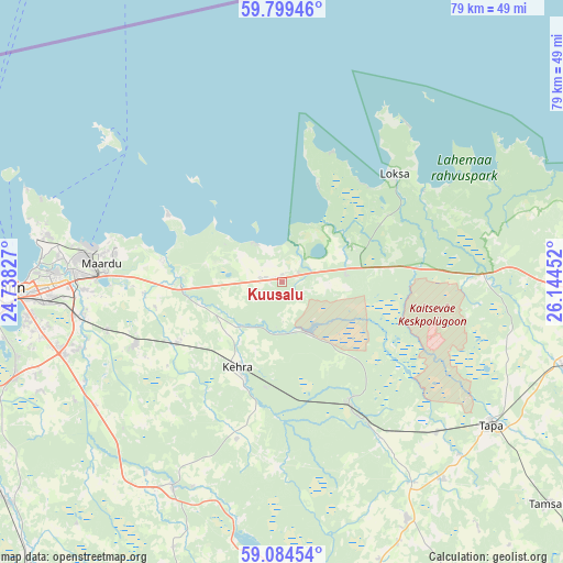
Kuusalu GPS coordinates[2]
59° 26' 38.004" North, 25° 26' 29.004" East
| Map corner | latitude | longitude |
|---|---|---|
| Upper-left | 59.79946°, | 24.73827° |
| Center: | 59.44389°, | 25.44139° |
| Lower-right: | 59.08454°, | 26.14452° |
| Map W x H: | 79.5×79.5 km | = 49.4×49.4mi |
| max Lat: | 59.57639° ⇑8.4% North |
| Kuusalu: | 59.44389° |
| min Lat: | ⇓91.6% South 57.72778° |
| min Long | Kuusalu | max Long |
| 22.24646° | 25.44139° | 28.19028° |
| W 48.9%⇐ | ⇒51.1% E |
Elevation
Elevation of Kuusalu is 46 m = 151 ft, and this is 7.2 m = 24 ft below average elevation for this country.
| Max E: |
141 m = 463 ft | 61.6% |
| Avg. | 53.2 m = 175 ft | |
| Kuusalu | 46 m = 151 ft | |
Min E: |
6 m = 20 ft | 38.4% |
See also: Estonia elevation on elevation.city.
Geographical zone
Kuusalu is located in North temperate zone (between Tropic of Cancer and the Arctic Circle). Distance of this North polar circle is 791.6 km =491.9 mi to North.| Distance of | km | miles | from Kuusalu |
|---|---|---|---|
| North Pole | 3397.5 | 2111.1 | to North |
| Arctic Circle | 791.6 | 491.9 | to North |
| Tropic Cancer | 4003.6 | 2487.7 | to South |
| Equator | 6609.5 | 4107 | to South |


Nearby cities:
15 places around Kuusalu: (largest is in red/bold)
• Aegviidu
20.1 km =12.5 mi,  150°
150°
• Aruküla
22.4 km =13.9 mi,  247°
247°
• Kehra
13.8 km =8.6 mi,  209°
209°
• Kiiu
3.5 km =2.2 mi,  277°
277°
• Kose
31.9 km =19.8 mi,  273°
273°
• Kostivere
19.5 km =12.1 mi,  264°
264°
• Lagedi
28.8 km =17.9 mi, 261°
• Lehtmetsa
14.6 km =9.1 mi,  199°
199°
• Loksa
21.6 km =13.4 mi,  46°
46°
• Loo
27.8 km =17.3 mi, 267°
• Maardu
26.1 km =16.2 mi, 275°
• Raasiku
17 km =10.6 mi,  239°
239°
• Randvere
31 km =19.3 mi, 283°
• Vaida
31.6 km =19.6 mi, 236°
• Valkla
7.4 km =4.6 mi,  295°
295°
Sources, notices
• [Note1] Compared only with cities in Estonia existing in our database
• [Src1] Map data: © OpenStreetMap contributors (CC-BY-SA)
• [Src2] Other city data from geonames.org with taken over terms of usage.
• [Src3] Geographical zone / Annual Mean Temperature by Robert A. Rohde @ Wikipedia
