Iisaku geodata
Iisaku (Ida-Virumaa) is a seat of a second-order administrative division; located in Estonia in Europe/Tallinn (GMT+3) time zone. With population of 916 people, there are 101 cities with bigger population in this country. Compared to other cities in Estonia, 61.1% of cities are located further ↓South; 94.2% of cities are located further ←West and 77.9% of cities have lower elevation than Iisaku. Note1


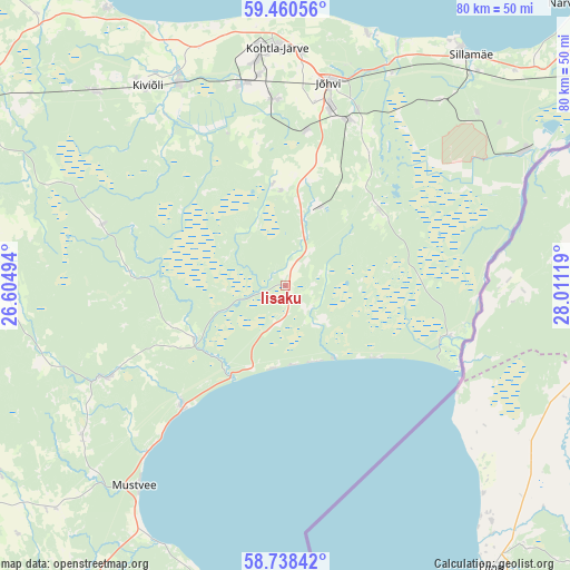
Iisaku GPS coordinates[2]
59° 6' 5.004" North, 27° 18' 29.016" East
| Map corner | latitude | longitude |
|---|---|---|
| Upper-left | 59.46056°, | 26.60494° |
| Center: | 59.10139°, | 27.30806° |
| Lower-right: | 58.73842°, | 28.01119° |
| Map W x H: | 80.3×80.3 km | = 49.9×49.9mi |
| max Lat: | 59.57639° ⇑38.9% North |
| Iisaku: | 59.10139° |
| min Lat: | ⇓61.1% South 57.72778° |
| min Long | Iisaku | max Long |
| 22.24646° | 27.30806° | 28.19028° |
| W 94.2%⇐ | ⇒5.8% E |
Elevation
Elevation of Iisaku is 75 m = 246 ft, and this is 21.8 m = 72 ft above average elevation for this country.
| Max E: |
141 m = 463 ft | 22.1% |
| Iisaku | 75 m 246 ft | |
| Avg. | 53.2 m = 175 ft | |
Min E: |
6 m = 20 ft | 77.9% |
See also: Estonia elevation on elevation.city.
Geographical zone
Iisaku is located in North temperate zone (between Tropic of Cancer and the Arctic Circle). Distance of this North polar circle is 829.7 km =515.6 mi to North.| Distance of | km | miles | from Iisaku |
|---|---|---|---|
| North Pole | 3435.6 | 2134.8 | to North |
| Arctic Circle | 829.7 | 515.6 | to North |
| Tropic Cancer | 3965.5 | 2464 | to South |
| Equator | 6571.5 | 4083.3 | to South |


Nearby cities:
15 places around Iisaku: (largest is in red/bold)
• Avinurme
28.6 km =17.8 mi,  242°
242°
• Järve
33.9 km =21.1 mi,  0°
0°
• Jõhvi
29.4 km =18.3 mi,  12°
12°
• Kiviõli
33.9 km =21.1 mi,  325°
325°
• Kohtla-Järve
33.1 km =20.6 mi,  356°
356°
• Kohtla-Nõmme
28.8 km =17.9 mi,  344°
344°
• Mustvee
35.2 km =21.9 mi,  216°
216°
• Mäetaguse
14.4 km =8.9 mi,  351°
351°
• Püssi
32.3 km =20.1 mi, 332°
• Roela
41.1 km =25.5 mi,  280°
280°
• Sillamäe
41.8 km =26 mi,  38°
38°
• Sonda
38 km =23.6 mi,  315°
315°
• Toila
37.3 km =23.2 mi,  17°
17°
• Torma
45.8 km =28.5 mi,  225°
225°
• Voka
37.5 km =23.3 mi, 24°
Sources, notices
• [Note1] Compared only with cities in Estonia existing in our database
• [Src1] Map data: © OpenStreetMap contributors (CC-BY-SA)
• [Src2] Other city data from geonames.org with taken over terms of usage.
• [Src3] Geographical zone / Annual Mean Temperature by Robert A. Rohde @ Wikipedia
