Mustvee geodata
Mustvee (Jõgevamaa) is a seat of a second-order administrative division; located in Estonia in Europe/Tallinn (GMT+3) time zone. With population of 1,662 people, there are 56 cities with bigger population in this country. Compared to other cities in Estonia, 50.5% of cities are located further ↑North; 84.2% of cities are located further ←West and 71.6% of cities have higher elevation than Mustvee. Note1


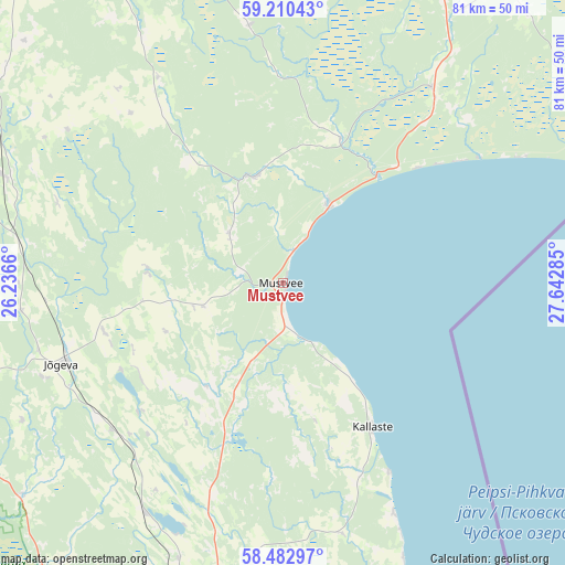
Mustvee GPS coordinates[2]
58° 50' 54.996" North, 26° 56' 22.992" East
| Map corner | latitude | longitude |
|---|---|---|
| Upper-left | 59.21043°, | 26.2366° |
| Center: | 58.84861°, | 26.93972° |
| Lower-right: | 58.48297°, | 27.64285° |
| Map W x H: | 80.9×80.9 km | = 50.3×50.3mi |
| max Lat: | 59.57639° ⇑50.5% North |
| Mustvee: | 58.84861° |
| min Lat: | ⇓49.5% South 57.72778° |
| min Long | Mustvee | max Long |
| 22.24646° | 26.93972° | 28.19028° |
| W 84.2%⇐ | ⇒15.8% E |
Elevation
Elevation of Mustvee is 39 m = 128 ft, and this is 14.2 m = 47 ft below average elevation for this country.
| Max E: |
141 m = 463 ft | 71.6% |
| Avg. | 53.2 m = 175 ft | |
| Mustvee | 39 m = 128 ft | |
Min E: |
6 m = 20 ft | 28.4% |
See also: Estonia elevation on elevation.city.
Geographical zone
Mustvee is located in North temperate zone (between Tropic of Cancer and the Arctic Circle). Distance of this North polar circle is 857.8 km =533 mi to North.| Distance of | km | miles | from Mustvee |
|---|---|---|---|
| North Pole | 3463.7 | 2152.2 | to North |
| Arctic Circle | 857.8 | 533 | to North |
| Tropic Cancer | 3937.4 | 2446.6 | to South |
| Equator | 6543.4 | 4065.9 | to South |


Nearby cities:
15 places around Mustvee: (largest is in red/bold)
• Alatskivi
30 km =18.6 mi,  158°
158°
• Avinurme
15.5 km =9.6 mi,  343°
343°
• Iisaku
35.2 km =21.9 mi,  36°
36°
• Jõgeva
33.4 km =20.8 mi,  250°
250°
• Kallaste
24.3 km =15.1 mi,  148°
148°
• Koosa
37.4 km =23.2 mi,  167°
167°
• Kuremaa
27.1 km =16.8 mi,  242°
242°
• Kõrveküla
48.1 km =29.9 mi,  190°
190°
• Mäetaguse
46.4 km =28.8 mi,  24°
24°
• Palamuse
27.6 km =17.1 mi,  228°
228°
• Puurmani
48.7 km =30.3 mi, 231°
• Rakke
42 km =26.1 mi,  290°
290°
• Roela
40.7 km =25.3 mi,  331°
331°
• Siimusti
37 km =23 mi, 249°
• Torma
12.3 km =7.6 mi, 251°
Sources, notices
• [Note1] Compared only with cities in Estonia existing in our database
• [Src1] Map data: © OpenStreetMap contributors (CC-BY-SA)
• [Src2] Other city data from geonames.org with taken over terms of usage.
• [Src3] Geographical zone / Annual Mean Temperature by Robert A. Rohde @ Wikipedia
