Sumusţā as Sulţānī geodata
Sumusţā as Sulţānī (Beni Suweif) is a populated place; located in Egypt in Africa/Cairo (GMT+2) time zone. With population of 37,260 people, there are 109 cities with bigger population in this country. Compared to other cities in Egypt, 65.9% of cities are located further ↑North; 75.4% of cities are located further →East and 65.9% of cities have lower elevation than Sumusţā as Sulţānī. Note1


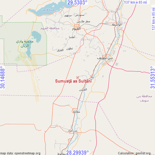
Sumusţā as Sulţānī GPS coordinates[2]
28° 55' 0.012" North, 30° 51' 0" East
| Map corner | latitude | longitude |
|---|---|---|
| Upper-left | 29.5303°, | 30.14688° |
| Center: | 28.91667°, | 30.85° |
| Lower-right: | 28.29939°, | 31.55313° |
| Map W x H: | 136.9×136.9 km | = 85.1×85.1mi |
| max Lat: | 31.5084° ⇑65.9% North |
| Sumusţā as Sulţānī: | 28.91667° |
| min Lat: | ⇓34.1% South 22.3457° |
| min Long | Sumusţā as Su | max Long |
| 25.51965° | 30.85° | 34.89572° |
| W 24.6%⇐ | ⇒75.4% E |
Elevation
Elevation of Sumusţā as Sulţānī is 28 m = 92 ft, and this is 15.5 m = 51 ft below average elevation for this country.
| Max E: |
1565 m = 5135 ft | 34.1% |
| Avg. | 43.5 m = 143 ft | |
| Sumusţā as Sulţānī | 28 m = 92 ft | |
Min E: |
-15 m = -49 ft | 65.9% |
See also: Egypt elevation on elevation.city.
Geographical zone
Sumusţā as Sulţānī is located in North temperate zone (between Tropic of Cancer and the Arctic Circle). Distance of this Northern Tropic circle is 609.3 km =378.6 mi to South.| Distance of | km | miles | from Sumusţā as Sulţānī |
|---|---|---|---|
| North Pole | 6791.8 | 4220.2 | to North |
| Arctic Circle | 4185.9 | 2601 | to North |
| Tropic Cancer | 609.3 | 378.6 | to South |
| Equator | 3215.2 | 1997.8 | to South |


Nearby cities:
15 places around Sumusţā as Sulţānī: (largest is in red/bold)
• Al Fashn
11.3 km =7 mi,  154°
154°
• Al Fayyūm
43.7 km =27.2 mi,  358°
358°
• Al Minyā
90.2 km =56 mi,  186°
186°
• Al Wāsiţah
58.2 km =36.2 mi,  36°
36°
• Al ‘Ayyāţ
87.6 km =54.4 mi,  26°
26°
• Aş Şaff
83.3 km =51.8 mi, 30°
• Banī Mazār
46.2 km =28.7 mi, 186°
• Banī Suwayf
29.8 km =18.5 mi,  53°
53°
• Būsh
37.3 km =23.2 mi, 46°
• Ibshawāy
51.9 km =32.2 mi,  341°
341°
• Iţsā
36.2 km =22.5 mi,  350°
350°
• Madīnat Sittah Uktūbar
101.9 km =63.3 mi,  10°
10°
• Maţāy
55.8 km =34.7 mi, 187°
• Samālūţ
68.6 km =42.6 mi, 191°
• Ţāmiyah
63.2 km =39.3 mi, 9°
Sources, notices
• [Note1] Compared only with cities in Egypt existing in our database
• [Src1] Map data: © OpenStreetMap contributors (CC-BY-SA)
• [Src2] Other city data from geonames.org with taken over terms of usage.
• [Src3] Geographical zone / Annual Mean Temperature by Robert A. Rohde @ Wikipedia
