Villaverde y Pasaconsol geodata
Villaverde y Pasaconsol (Castille-La Mancha) is a seat of a third-order administrative division; located in Spain in Europe/Madrid (GMT+2) time zone. With population of 413 people, there are 4102 cities with bigger population in this country. Compared to other cities in Spain, 73.2% of cities are located further ↑North; 64% of cities are located further ←West and 76.1% of cities have lower elevation than Villaverde y Pasaconsol. Note1
Administrative division(s):
- Level 1: Castille-La Mancha
- Level 2: Provincia de Cuenca
- Level 3: Villaverde y Pasaconsol
Current local time in Villaverde y Pasaconsol:
11:53 PM, ThursdayDifference from your time zone: hours


Villaverde y Pasaconsol GPS coordinates[2]
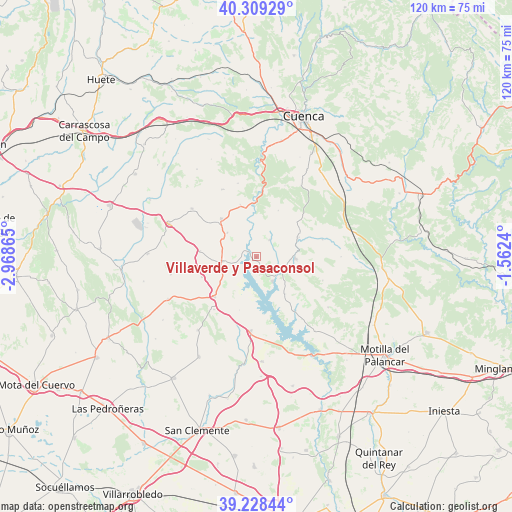
39° 46' 15.564" North, 2° 15' 55.872" West
| Map corner | latitude | longitude |
|---|---|---|
| Upper-left | 40.30929°, | -2.96865° |
| Center: | 39.77099°, | -2.26552° |
| Lower-right: | 39.22844°, | -1.5624° |
| Map W x H: | 120.2×120.2 km | = 74.7×74.7mi |
| max Lat: | 43.74134° ⇑73.2% North |
| Villaverde y Pasaconsol: | 39.77099° |
| min Lat: | ⇓26.8% South 27.64134° |
| min Long | Villaverde y Pa | max Long |
| -18.00367° | -2.26552° | 4.2899° |
| W 64%⇐ | ⇒36% E |
Elevation
Elevation of Villaverde y Pasaconsol is 861 m = 2825 ft, and this is 263 m = 863 ft above average elevation for this country.
| Max E: |
1682 m = 5518 ft | 23.9% |
| Villaverde y Pasaconsol | 861 m 2825 ft | |
| Avg. | 598 m = 1962 ft | |
Min E: |
0 m = 0 ft | 76.1% |
See also: Spain elevation on elevation.city.
Geographical zone
Villaverde y Pasaconsol is located in North temperate zone (between Tropic of Cancer and the Arctic Circle). Distance of this Northern Tropic circle is 1816.2 km =1128.5 mi to South.| Distance of | km | miles | from Villaverde y Pasaconsol |
|---|---|---|---|
| North Pole | 5584.9 | 3470.3 | to North |
| Arctic Circle | 2979.1 | 1851.1 | to North |
| Tropic Cancer | 1816.2 | 1128.5 | to South |
| Equator | 4422.1 | 2747.8 | to South |


Nearby cities:
15 places around Villaverde y Pasaconsol: (largest is in red/bold)
• Albaladejo del Cuende
5.1 km =3.2 mi,  38°
38°
• Altarejos
17.6 km =10.9 mi,  333°
333°
• Belmontejo
8.8 km =5.5 mi,  310°
310°
• Buenache de Alarcón
15.9 km =9.9 mi,  147°
147°
• Castillo de Garcimuñoz
15.8 km =9.8 mi,  218°
218°
• Cervera del Llano
13.3 km =8.3 mi,  275°
275°
• Honrubia
17.6 km =10.9 mi,  184°
184°
• Hontecillas
10.6 km =6.6 mi,  138°
138°
• La Almarcha
13.6 km =8.5 mi,  226°
226°
• Mota de Altarejos
12.9 km =8 mi,  343°
343°
• Olivares de Júcar
7.8 km =4.8 mi,  261°
261°
• Olmeda del Rey
15.9 km =9.9 mi,  78°
78°
• San Lorenzo de la Parrilla
12.1 km =7.5 mi,  317°
317°
• Torrubia del Castillo
13.1 km =8.1 mi,  197°
197°
• Valverde de Júcar
6.9 km =4.3 mi, 147°
Sources, notices
• [Note1] Compared only with cities in Spain existing in our database
• [Src1] Map data: © OpenStreetMap contributors (CC-BY-SA)
• [Src2] Other city data from geonames.org with taken over terms of usage.
• [Src3] Geographical zone / Annual Mean Temperature by Robert A. Rohde @ Wikipedia
