Villatoya geodata
Villatoya (Castille-La Mancha) is a seat of a third-order administrative division; located in Spain in Europe/Madrid (GMT+2) time zone. With population of 197 people, there are 5052 cities with bigger population in this country. Compared to other cities in Spain, 78.4% of cities are located further ↑North; 74.8% of cities are located further ←West and 69.3% of cities have higher elevation than Villatoya. Note1
Administrative division(s):
- Level 1: Castille-La Mancha
- Level 2: Provincia de Albacete
- Level 3: Villatoya


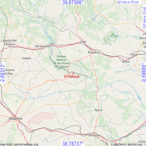
Villatoya GPS coordinates[2]
39° 19' 59.988" North, 1° 18' 0" West
| Map corner | latitude | longitude |
|---|---|---|
| Upper-left | 39.87506°, | -2.00313° |
| Center: | 39.33333°, | -1.3° |
| Lower-right: | 38.78737°, | -0.59688° |
| Map W x H: | 120.9×120.9 km | = 75.1×75.1mi |
| max Lat: | 43.74134° ⇑78.4% North |
| Villatoya: | 39.33333° |
| min Lat: | ⇓21.6% South 27.64134° |
| min Long | Villatoya | max Long |
| -18.00367° | -1.3° | 4.2899° |
| W 74.8%⇐ | ⇒25.2% E |
Elevation
Elevation of Villatoya is 395 m = 1296 ft, and this is 203 m = 666 ft below average elevation for this country.
| Max E: |
1682 m = 5518 ft | 69.3% |
| Avg. | 598 m = 1962 ft | |
| Villatoya | 395 m = 1296 ft | |
Min E: |
0 m = 0 ft | 30.7% |
See also: Spain elevation on elevation.city.
Geographical zone
Villatoya is located in North temperate zone (between Tropic of Cancer and the Arctic Circle). Distance of this Northern Tropic circle is 1767.5 km =1098.3 mi to South.| Distance of | km | miles | from Villatoya |
|---|---|---|---|
| North Pole | 5633.6 | 3500.6 | to North |
| Arctic Circle | 3027.7 | 1881.3 | to North |
| Tropic Cancer | 1767.5 | 1098.3 | to South |
| Equator | 4373.5 | 2717.6 | to South |


Nearby cities:
15 places around Villatoya: (largest is in red/bold)
• Abengibre
23.9 km =14.9 mi,  237°
237°
• Alborea
9.1 km =5.7 mi,  232°
232°
• Alcalá del Júcar
19.2 km =11.9 mi,  215°
215°
• Balsa de Ves
11.4 km =7.1 mi,  130°
130°
• Casas Ibáñez
15.4 km =9.6 mi,  248°
248°
• Casas de Ves
9.7 km =6 mi,  197°
197°
• Caudete de las Fuentes
25.2 km =15.7 mi,  4°
4°
• Cofrentes
23.6 km =14.7 mi,  119°
119°
• Fuentealbilla
22.8 km =14.2 mi, 250°
• Jalance
25 km =15.5 mi, 126°
• Requena
24.3 km =15.1 mi,  44°
44°
• Venta del Moro
17.2 km =10.7 mi,  345°
345°
• Villa de Ves
15.9 km =9.9 mi,  158°
158°
• Villamalea
24.6 km =15.3 mi,  278°
278°
• Villargordo del Cabriel
25 km =15.5 mi,  332°
332°
Sources, notices
• [Note1] Compared only with cities in Spain existing in our database
• [Src1] Map data: © OpenStreetMap contributors (CC-BY-SA)
• [Src2] Other city data from geonames.org with taken over terms of usage.
• [Src3] Geographical zone / Annual Mean Temperature by Robert A. Rohde @ Wikipedia
