Tomelloso geodata
Tomelloso (Castille-La Mancha) is a populated place; located in Spain in Europe/Madrid (GMT+2) time zone. With population of 38,095 people, there are 235 cities with bigger population in this country. Compared to other cities in Spain, 79.8% of cities are located further ↑North; 54% of cities are located further ←West and 51% of cities have lower elevation than Tomelloso. Note1
Administrative division(s):
- Level 1: Castille-La Mancha
- Level 2: Provincia de Ciudad Real
- Level 3: Argamasilla de Alba


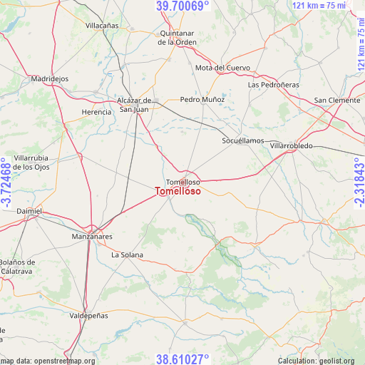
Tomelloso GPS coordinates[2]
39° 9' 27.324" North, 3° 1' 17.616" West
| Map corner | latitude | longitude |
|---|---|---|
| Upper-left | 39.70069°, | -3.72468° |
| Center: | 39.15759°, | -3.02156° |
| Lower-right: | 38.61027°, | -2.31843° |
| Map W x H: | 121.2×121.2 km | = 75.3×75.3mi |
| max Lat: | 43.74134° ⇑79.8% North |
| Tomelloso: | 39.15759° |
| min Lat: | ⇓20.2% South 27.64134° |
| min Long | Tomelloso | max Long |
| -18.00367° | -3.02156° | 4.2899° |
| W 54%⇐ | ⇒46% E |
Elevation
Elevation of Tomelloso is 669 m = 2195 ft, and this is 71 m = 233 ft above average elevation for this country.
| Max E: |
1682 m = 5518 ft | 49% |
| Tomelloso | 669 m 2195 ft | |
| Avg. | 598 m = 1962 ft | |
Min E: |
0 m = 0 ft | 51% |
See also: Spain elevation on elevation.city.
Geographical zone
Tomelloso is located in North temperate zone (between Tropic of Cancer and the Arctic Circle). Distance of this Northern Tropic circle is 1748 km =1086.2 mi to South.| Distance of | km | miles | from Tomelloso |
|---|---|---|---|
| North Pole | 5653.1 | 3512.7 | to North |
| Arctic Circle | 3047.3 | 1893.5 | to North |
| Tropic Cancer | 1748 | 1086.2 | to South |
| Equator | 4353.9 | 2705.4 | to South |


Nearby cities:
15 places around Tomelloso: (largest is in red/bold)
• Alcázar de San Juan
30.4 km =18.9 mi,  328°
328°
• Alhambra
28.9 km =18 mi,  185°
185°
• Argamasilla de Alba
6.9 km =4.3 mi,  242°
242°
• Campo de Criptana
28.9 km =18 mi,  342°
342°
• Carrizosa
35.2 km =21.9 mi,  175°
175°
• La Solana
30.2 km =18.8 mi,  218°
218°
• Las Mesas
33.9 km =21.1 mi,  40°
40°
• Llanos del Caudillo
28.8 km =17.9 mi,  261°
261°
• Manzanares
34.8 km =21.6 mi, 239°
• Membrilla
34.6 km =21.5 mi,  233°
233°
• Ossa de Montiel
32.1 km =19.9 mi,  132°
132°
• Pedro Muñoz
28 km =17.4 mi,  13°
13°
• Ruidera
23.3 km =14.5 mi,  149°
149°
• Socuéllamos
24.4 km =15.2 mi,  54°
54°
• Villarta de San Juan
35.8 km =22.2 mi,  284°
284°
Sources, notices
• [Note1] Compared only with cities in Spain existing in our database
• [Src1] Map data: © OpenStreetMap contributors (CC-BY-SA)
• [Src2] Other city data from geonames.org with taken over terms of usage.
• [Src3] Geographical zone / Annual Mean Temperature by Robert A. Rohde @ Wikipedia
