Carrizosa geodata
Carrizosa (Castille-La Mancha) is a seat of a third-order administrative division; located in Spain in Europe/Madrid (GMT+2) time zone. With population of 1,556 people, there are 2419 cities with bigger population in this country. Compared to other cities in Spain, 82.8% of cities are located further ↑North; 54.7% of cities are located further ←West and 71.6% of cities have lower elevation than Carrizosa. Note1
Administrative division(s):
- Level 1: Castille-La Mancha
- Level 2: Provincia de Ciudad Real
- Level 3: Carrizosa


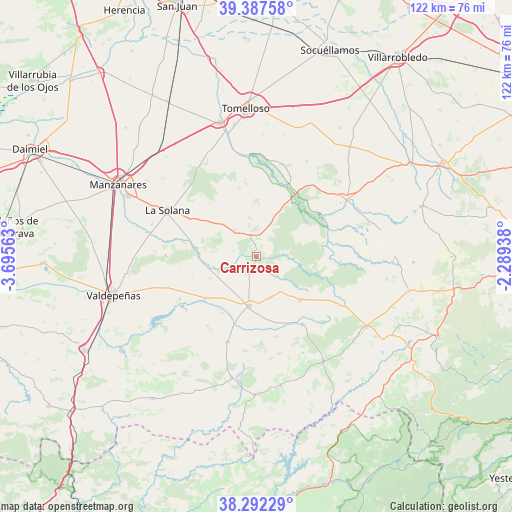
Carrizosa GPS coordinates[2]
38° 50' 31.344" North, 2° 59' 33" West
| Map corner | latitude | longitude |
|---|---|---|
| Upper-left | 39.38758°, | -3.69563° |
| Center: | 38.84204°, | -2.9925° |
| Lower-right: | 38.29229°, | -2.28938° |
| Map W x H: | 121.8×121.8 km | = 75.7×75.7mi |
| max Lat: | 43.74134° ⇑82.8% North |
| Carrizosa: | 38.84204° |
| min Lat: | ⇓17.2% South 27.64134° |
| min Long | Carrizosa | max Long |
| -18.00367° | -2.9925° | 4.2899° |
| W 54.7%⇐ | ⇒45.3% E |
Elevation
Elevation of Carrizosa is 825 m = 2707 ft, and this is 227 m = 745 ft above average elevation for this country.
| Max E: |
1682 m = 5518 ft | 28.4% |
| Carrizosa | 825 m 2707 ft | |
| Avg. | 598 m = 1962 ft | |
Min E: |
0 m = 0 ft | 71.6% |
See also: Spain elevation on elevation.city.
Geographical zone
Carrizosa is located in North temperate zone (between Tropic of Cancer and the Arctic Circle). Distance of this Northern Tropic circle is 1712.9 km =1064.3 mi to South.| Distance of | km | miles | from Carrizosa |
|---|---|---|---|
| North Pole | 5688.2 | 3534.5 | to North |
| Arctic Circle | 3082.3 | 1915.3 | to North |
| Tropic Cancer | 1712.9 | 1064.3 | to South |
| Equator | 4318.8 | 2683.6 | to South |


Nearby cities:
15 places around Carrizosa: (largest is in red/bold)
• Alcubillas
15.8 km =9.8 mi,  231°
231°
• Alhambra
8.3 km =5.2 mi,  320°
320°
• Almedina
24.4 km =15.2 mi,  172°
172°
• Cózar
21.2 km =13.2 mi,  199°
199°
• Fuenllana
10 km =6.2 mi,  162°
162°
• Infantes
11.8 km =7.3 mi,  188°
188°
• La Solana
24.1 km =15 mi,  298°
298°
• Montiel
19.5 km =12.1 mi,  145°
145°
• Ossa de Montiel
25.3 km =15.7 mi,  57°
57°
• Ruidera
17.8 km =11.1 mi,  32°
32°
• San Carlos del Valle
21.6 km =13.4 mi,  270°
270°
• Santa Cruz de los Cáñamos
25.2 km =15.7 mi, 154°
• Terrinches
28.9 km =18 mi, 153°
• Torre de Juan Abad
29.3 km =18.2 mi, 191°
• Villahermosa
14.7 km =9.1 mi,  134°
134°
Sources, notices
• [Note1] Compared only with cities in Spain existing in our database
• [Src1] Map data: © OpenStreetMap contributors (CC-BY-SA)
• [Src2] Other city data from geonames.org with taken over terms of usage.
• [Src3] Geographical zone / Annual Mean Temperature by Robert A. Rohde @ Wikipedia
