Ruidera geodata
Ruidera (Castille-La Mancha) is a seat of a third-order administrative division; located in Spain in Europe/Madrid (GMT+2) time zone. With population of 598 people, there are 3616 cities with bigger population in this country. Compared to other cities in Spain, 81.2% of cities are located further ↑North; 56.2% of cities are located further ←West and 66.3% of cities have lower elevation than Ruidera. Note1
Administrative division(s):
- Level 1: Castille-La Mancha
- Level 2: Provincia de Ciudad Real
- Level 3: Ruidera


Ruidera GPS coordinates[2]
38° 58' 39.9" North, 2° 52' 59.556" West
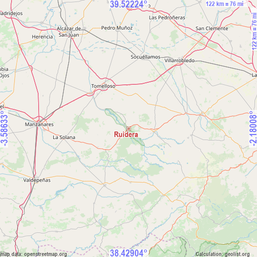
| Map corner | latitude | longitude |
|---|---|---|
| Upper-left | 39.52224°, | -3.58633° |
| Center: | 38.97775°, | -2.88321° |
| Lower-right: | 38.42904°, | -2.18008° |
| Map W x H: | 121.6×121.6 km | = 75.6×75.6mi |
| max Lat: | 43.74134° ⇑81.2% North |
| Ruidera: | 38.97775° |
| min Lat: | ⇓18.8% South 27.64134° |
| min Long | Ruidera | max Long |
| -18.00367° | -2.88321° | 4.2899° |
| W 56.2%⇐ | ⇒43.8% E |
Elevation
Elevation of Ruidera is 787 m = 2582 ft, and this is 189 m = 620 ft above average elevation for this country.
| Max E: |
1682 m = 5518 ft | 33.7% |
| Ruidera | 787 m 2582 ft | |
| Avg. | 598 m = 1962 ft | |
Min E: |
0 m = 0 ft | 66.3% |
See also: Spain elevation on elevation.city.
Geographical zone
Ruidera is located in North temperate zone (between Tropic of Cancer and the Arctic Circle). Distance of this Northern Tropic circle is 1728 km =1073.7 mi to South.| Distance of | km | miles | from Ruidera |
|---|---|---|---|
| North Pole | 5673.1 | 3525.1 | to North |
| Arctic Circle | 3067.3 | 1905.9 | to North |
| Tropic Cancer | 1728 | 1073.7 | to South |
| Equator | 4333.9 | 2693 | to South |


Nearby cities:
15 places around Ruidera: (largest is in red/bold)
• Alcubillas
33.1 km =20.6 mi,  221°
221°
• Alhambra
17.1 km =10.6 mi,  239°
239°
• Argamasilla de Alba
24.7 km =15.3 mi,  312°
312°
• Carrizosa
17.8 km =11.1 mi,  212°
212°
• El Bonillo
29.8 km =18.5 mi,  95°
95°
• Fuenllana
25.5 km =15.8 mi,  194°
194°
• Infantes
29 km =18 mi,  202°
202°
• La Solana
30.9 km =19.2 mi,  263°
263°
• Montiel
31.1 km =19.3 mi,  177°
177°
• Ossa de Montiel
12 km =7.5 mi, 97°
• San Carlos del Valle
34.4 km =21.4 mi, 244°
• Socuéllamos
35.1 km =21.8 mi,  12°
12°
• Tomelloso
23.3 km =14.5 mi,  329°
329°
• Villahermosa
25.3 km =15.7 mi, 177°
• Viveros
35.1 km =21.8 mi,  130°
130°
Sources, notices
• [Note1] Compared only with cities in Spain existing in our database
• [Src1] Map data: © OpenStreetMap contributors (CC-BY-SA)
• [Src2] Other city data from geonames.org with taken over terms of usage.
• [Src3] Geographical zone / Annual Mean Temperature by Robert A. Rohde @ Wikipedia
