Sant Antoni de Portmany geodata
Sant Antoni de Portmany (Balearic Islands) is a seat of a third-order administrative division; located in Spain in Europe/Madrid (GMT+2) time zone. With population of 21,852 people, there are 435 cities with bigger population in this country. Compared to other cities in Spain, 81.1% of cities are located further ↑North; 91.3% of cities are located further ←West and 97.3% of cities have higher elevation than Sant Antoni de Portmany. Note1
Administrative division(s):
- Level 1: Balearic Islands
- Level 2: Illes Balears
- Level 3: Sant Antoni de Portmany
Current local time in Sant Antoni de Portmany:
09:16 PM, ThursdayDifference from your time zone: hours


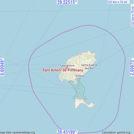
Sant Antoni de Portmany GPS coordinates[2]
38° 58' 50.448" North, 1° 18' 13.032" East
| Map corner | latitude | longitude |
|---|---|---|
| Upper-left | 39.52515°, | 0.60049° |
| Center: | 38.98068°, | 1.30362° |
| Lower-right: | 38.43199°, | 2.00675° |
| Map W x H: | 121.5×121.5 km | = 75.5×75.5mi |
| max Lat: | 43.74134° ⇑81.1% North |
| Sant Antoni de Portmany: | 38.98068° |
| min Lat: | ⇓18.9% South 27.64134° |
| min Long | Sant Antoni de | max Long |
| -18.00367° | 1.30362° | 4.2899° |
| W 91.3%⇐ | ⇒8.7% E |
Elevation
Elevation of Sant Antoni de Portmany is 14 m = 46 ft, and this is 584 m = 1916 ft below average elevation for this country.
| Max E: |
1682 m = 5518 ft | 97.3% |
| Avg. | 598 m = 1962 ft | |
| Sant Antoni de Portmany | 14 m = 46 ft | |
Min E: |
0 m = 0 ft | 2.7% |
See also: Spain elevation on elevation.city.
Geographical zone
Sant Antoni de Portmany is located in North temperate zone (between Tropic of Cancer and the Arctic Circle). Distance of this Northern Tropic circle is 1728.3 km =1073.9 mi to South.| Distance of | km | miles | from Sant Antoni de Portmany |
|---|---|---|---|
| North Pole | 5672.8 | 3524.9 | to North |
| Arctic Circle | 3066.9 | 1905.7 | to North |
| Tropic Cancer | 1728.3 | 1073.9 | to South |
| Equator | 4334.2 | 2693.1 | to South |


Nearby cities:
15 places around Sant Antoni de Portmany: (largest is in red/bold)
• Benitachell
104.2 km =64.7 mi,  254°
254°
• Cala de Portinatx
23.3 km =14.5 mi,  52°
52°
• Denia
104.8 km =65.1 mi,  261°
261°
• Es Cubells
11.4 km =7.1 mi,  193°
193°
• Es Pujols
31.7 km =19.7 mi,  155°
155°
• Gata de Gorgos
107.9 km =67 mi, 257°
• Ibiza
13.7 km =8.5 mi,  125°
125°
• Javea
100.8 km =62.6 mi, 257°
• La Savina
29.5 km =18.3 mi, 160°
• Moraira
106.3 km =66.1 mi, 252°
• Sant Francesc de Formentera
32.4 km =20.1 mi, 160°
• Sant Joan de Labritja
21.2 km =13.2 mi,  58°
58°
• Sant Josep de sa Talaia
6.5 km =4 mi, 187°
• Santa Eulària des Riu
19.9 km =12.4 mi,  88°
88°
• Teulada
107.6 km =66.9 mi, 254°
Sources, notices
• [Note1] Compared only with cities in Spain existing in our database
• [Src1] Map data: © OpenStreetMap contributors (CC-BY-SA)
• [Src2] Other city data from geonames.org with taken over terms of usage.
• [Src3] Geographical zone / Annual Mean Temperature by Robert A. Rohde @ Wikipedia
