Hontanaya geodata
Hontanaya (Castille-La Mancha) is a seat of a third-order administrative division; located in Spain in Europe/Madrid (GMT+2) time zone. With population of 425 people, there are 4064 cities with bigger population in this country. Compared to other cities in Spain, 74.2% of cities are located further ↑North; 57% of cities are located further ←West and 69.7% of cities have lower elevation than Hontanaya. Note1
Administrative division(s):
- Level 1: Castille-La Mancha
- Level 2: Provincia de Cuenca
- Level 3: Hontanaya


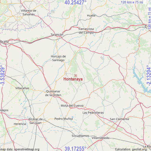
Hontanaya GPS coordinates[2]
39° 42' 55.908" North, 2° 50' 6.576" West
| Map corner | latitude | longitude |
|---|---|---|
| Upper-left | 40.25427°, | -3.53829° |
| Center: | 39.71553°, | -2.83516° |
| Lower-right: | 39.17255°, | -2.13204° |
| Map W x H: | 120.3×120.3 km | = 74.8×74.8mi |
| max Lat: | 43.74134° ⇑74.2% North |
| Hontanaya: | 39.71553° |
| min Lat: | ⇓25.8% South 27.64134° |
| min Long | Hontanaya | max Long |
| -18.00367° | -2.83516° | 4.2899° |
| W 57%⇐ | ⇒43% E |
Elevation
Elevation of Hontanaya is 812 m = 2664 ft, and this is 214 m = 702 ft above average elevation for this country.
| Max E: |
1682 m = 5518 ft | 30.3% |
| Hontanaya | 812 m 2664 ft | |
| Avg. | 598 m = 1962 ft | |
Min E: |
0 m = 0 ft | 69.7% |
See also: Spain elevation on elevation.city.
Geographical zone
Hontanaya is located in North temperate zone (between Tropic of Cancer and the Arctic Circle). Distance of this Northern Tropic circle is 1810 km =1124.7 mi to South.| Distance of | km | miles | from Hontanaya |
|---|---|---|---|
| North Pole | 5591.1 | 3474.1 | to North |
| Arctic Circle | 2985.2 | 1854.9 | to North |
| Tropic Cancer | 1810 | 1124.7 | to South |
| Equator | 4416 | 2744 | to South |


Nearby cities:
15 places around Hontanaya: (largest is in red/bold)
• Almonacid del Marquesado
13.3 km =8.3 mi,  25°
25°
• Belmonte
20.8 km =12.9 mi,  147°
147°
• Fuentelespino de Haro
14.5 km =9 mi,  101°
101°
• Horcajo de Santiago
19.8 km =12.3 mi,  315°
315°
• Los Hinojosos
12.4 km =7.7 mi,  176°
176°
• Monreal del Llano
17.5 km =10.9 mi,  158°
158°
• Osa de la Vega
8.9 km =5.5 mi,  133°
133°
• Pozorrubio
14.9 km =9.3 mi, 318°
• Puebla de Almenara
7.9 km =4.9 mi,  13°
13°
• Quintanar de la Orden
22.3 km =13.9 mi,  232°
232°
• Tresjuncos
7 km =4.3 mi, 103°
• Villaescusa de Haro
19 km =11.8 mi, 133°
• Villamayor de Santiago
7.7 km =4.8 mi,  282°
282°
• Villanueva de Alcardete
16 km =9.9 mi,  252°
252°
• Villarejo de Fuentes
14.3 km =8.9 mi,  55°
55°
Sources, notices
• [Note1] Compared only with cities in Spain existing in our database
• [Src1] Map data: © OpenStreetMap contributors (CC-BY-SA)
• [Src2] Other city data from geonames.org with taken over terms of usage.
• [Src3] Geographical zone / Annual Mean Temperature by Robert A. Rohde @ Wikipedia
