Peñarroya-Pueblonuevo geodata
Peñarroya-Pueblonuevo (Andalusia) is a seat of a third-order administrative division; located in Spain in Europe/Madrid (GMT+2) time zone. With population of 11,883 people, there are 753 cities with bigger population in this country. Compared to other cities in Spain, 86.8% of cities are located further ↑North; 75.9% of cities are located further →East and 58.7% of cities have higher elevation than Peñarroya-Pueblonuevo. Note1
Administrative division(s):
- Level 1: Andalusia
- Level 2: Province of Córdoba
- Level 3: Peñarroya-Pueblonuevo
Current local time in Peñarroya-Pueblonuevo:
09:15 PM, ThursdayDifference from your time zone: hours


Peñarroya-Pueblonuevo GPS coordinates[2]
38° 18' 0" North, 5° 16' 0.012" West
| Map corner | latitude | longitude |
|---|---|---|
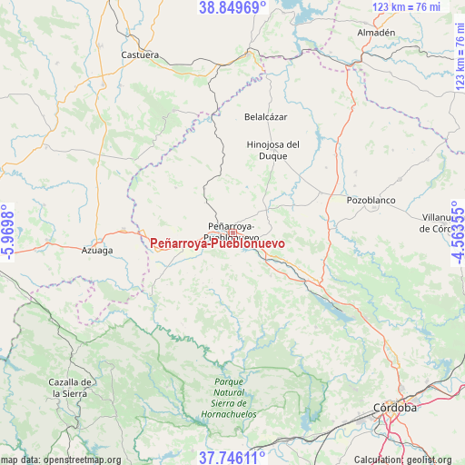
| Upper-left | 38.84969°, | -5.9698° |
| Center: | 38.3°, | -5.26667° |
| Lower-right: | 37.74611°, | -4.56355° |
| Map W x H: | 122.7×122.7 km | = 76.2×76.2mi |
| max Lat: | 43.74134° ⇑86.8% North |
| Peñarroya-Pueblonuevo: | 38.3° |
| min Lat: | ⇓13.2% South 27.64134° |
| min Long | Peñarroya-Pueb | max Long |
| -18.00367° | -5.26667° | 4.2899° |
| W 24.1%⇐ | ⇒75.9% E |
Elevation
Elevation of Peñarroya-Pueblonuevo is 544 m = 1785 ft, and this is 54 m = 177 ft below average elevation for this country.
| Max E: |
1682 m = 5518 ft | 58.7% |
| Avg. | 598 m = 1962 ft | |
| Peñarroya-Pueblonuevo | 544 m = 1785 ft | |
Min E: |
0 m = 0 ft | 41.3% |
See also: Spain elevation on elevation.city.
Geographical zone
Peñarroya-Pueblonuevo is located in North temperate zone (between Tropic of Cancer and the Arctic Circle). Distance of this Northern Tropic circle is 1652.6 km =1026.9 mi to South.| Distance of | km | miles | from Peñarroya-Pueblonuevo |
|---|---|---|---|
| North Pole | 5748.5 | 3572 | to North |
| Arctic Circle | 3142.6 | 1952.7 | to North |
| Tropic Cancer | 1652.6 | 1026.9 | to South |
| Equator | 4258.6 | 2646.2 | to South |


Nearby cities:
15 places around Peñarroya-Pueblonuevo: (largest is in red/bold)
• Alcaracejos
27.8 km =17.3 mi,  70°
70°
• Añora
34.5 km =21.4 mi, 67°
• Belalcázar
31.9 km =19.8 mi,  15°
15°
• Blázquez
18.3 km =11.4 mi,  307°
307°
• Bélmez
6.9 km =4.3 mi,  122°
122°
• El Viso
34.3 km =21.3 mi,  53°
53°
• Espiel
24.5 km =15.2 mi, 116°
• Fuente Obejuna
13.6 km =8.5 mi,  254°
254°
• Fuente la Lancha
24.1 km =15 mi,  57°
57°
• Granja de Torrehermosa
27.7 km =17.2 mi,  273°
273°
• Hinojosa del Duque
24.6 km =15.3 mi,  25°
25°
• Monterrubio de la Serena
35.7 km =22.2 mi,  334°
334°
• Villanueva del Duque
25 km =15.5 mi, 68°
• Villaralto
29.8 km =18.5 mi, 55°
• Villaviciosa de Córdoba
32.5 km =20.2 mi,  137°
137°
Sources, notices
• [Note1] Compared only with cities in Spain existing in our database
• [Src1] Map data: © OpenStreetMap contributors (CC-BY-SA)
• [Src2] Other city data from geonames.org with taken over terms of usage.
• [Src3] Geographical zone / Annual Mean Temperature by Robert A. Rohde @ Wikipedia
