Fuente Obejuna geodata
Fuente Obejuna (Andalusia) is a seat of a third-order administrative division; located in Spain in Europe/Madrid (GMT+2) time zone. With population of 5,451 people, there are 1224 cities with bigger population in this country. Compared to other cities in Spain, 86.9% of cities are located further ↑North; 77.6% of cities are located further →East and 54.1% of cities have higher elevation than Fuente Obejuna. Note1


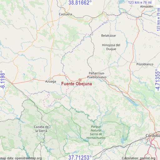
Fuente Obejuna GPS coordinates[2]
38° 16' 0.012" North, 5° 25' 0.012" West
| Map corner | latitude | longitude |
|---|---|---|
| Upper-left | 38.81662°, | -6.1198° |
| Center: | 38.26667°, | -5.41667° |
| Lower-right: | 37.71253°, | -4.71355° |
| Map W x H: | 122.8×122.8 km | = 76.3×76.3mi |
| max Lat: | 43.74134° ⇑86.9% North |
| Fuente Obejuna: | 38.26667° |
| min Lat: | ⇓13.1% South 27.64134° |
| min Long | Fuente Obejuna | max Long |
| -18.00367° | -5.41667° | 4.2899° |
| W 22.4%⇐ | ⇒77.6% E |
Elevation
Elevation of Fuente Obejuna is 610 m = 2001 ft, and this is 12 m = 39 ft above average elevation for this country.
| Max E: |
1682 m = 5518 ft | 54.1% |
| Fuente Obejuna | 610 m 2001 ft | |
| Avg. | 598 m = 1962 ft | |
Min E: |
0 m = 0 ft | 45.9% |
See also: Spain elevation on elevation.city.
Geographical zone
Fuente Obejuna is located in North temperate zone (between Tropic of Cancer and the Arctic Circle). Distance of this Northern Tropic circle is 1648.9 km =1024.6 mi to South.| Distance of | km | miles | from Fuente Obejuna |
|---|---|---|---|
| North Pole | 5752.2 | 3574.3 | to North |
| Arctic Circle | 3146.3 | 1955 | to North |
| Tropic Cancer | 1648.9 | 1024.6 | to South |
| Equator | 4254.9 | 2643.9 | to South |


Nearby cities:
15 places around Fuente Obejuna: (largest is in red/bold)
• Ahillones
37.8 km =23.5 mi,  270°
270°
• Alanís
36.9 km =22.9 mi,  225°
225°
• Azuaga
23.3 km =14.5 mi, 270°
• Berlanga
35 km =21.7 mi, 273°
• Blázquez
14.9 km =9.3 mi,  354°
354°
• Bélmez
18.9 km =11.7 mi,  90°
90°
• Espiel
35.7 km =22.2 mi,  101°
101°
• Fuente la Lancha
37.4 km =23.2 mi,  63°
63°
• Granja de Torrehermosa
15.6 km =9.7 mi,  290°
290°
• Hinojosa del Duque
35.1 km =21.8 mi,  42°
42°
• Malcocinado
28.7 km =17.8 mi, 234°
• Monterrubio de la Serena
35.9 km =22.3 mi,  355°
355°
• Peñarroya-Pueblonuevo
13.6 km =8.5 mi,  74°
74°
• San Nicolás del Puerto
36 km =22.4 mi,  214°
214°
• Valverde de Llerena
35.4 km =22 mi,  260°
260°
Sources, notices
• [Note1] Compared only with cities in Spain existing in our database
• [Src1] Map data: © OpenStreetMap contributors (CC-BY-SA)
• [Src2] Other city data from geonames.org with taken over terms of usage.
• [Src3] Geographical zone / Annual Mean Temperature by Robert A. Rohde @ Wikipedia
