Castilblanco geodata
Castilblanco (Extremadura) is a seat of a third-order administrative division; located in Spain in Europe/Madrid (GMT+2) time zone. With population of 1,167 people, there are 2756 cities with bigger population in this country. Compared to other cities in Spain, 78.7% of cities are located further ↑North; 73.6% of cities are located further →East and 61.5% of cities have higher elevation than Castilblanco. Note1
Administrative division(s):
- Level 1: Extremadura
- Level 2: Provincia de Badajoz
- Level 3: Castilblanco


Castilblanco GPS coordinates[2]
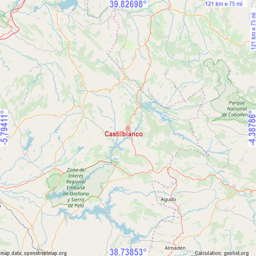
39° 17' 5.532" North, 5° 5' 27.528" West
| Map corner | latitude | longitude |
|---|---|---|
| Upper-left | 39.82698°, | -5.79411° |
| Center: | 39.28487°, | -5.09098° |
| Lower-right: | 38.73853°, | -4.38786° |
| Map W x H: | 121×121 km | = 75.2×75.2mi |
| max Lat: | 43.74134° ⇑78.7% North |
| Castilblanco: | 39.28487° |
| min Lat: | ⇓21.3% South 27.64134° |
| min Long | Castilblanco | max Long |
| -18.00367° | -5.09098° | 4.2899° |
| W 26.4%⇐ | ⇒73.6% E |
Elevation
Elevation of Castilblanco is 505 m = 1657 ft, and this is 93 m = 305 ft below average elevation for this country.
| Max E: |
1682 m = 5518 ft | 61.5% |
| Avg. | 598 m = 1962 ft | |
| Castilblanco | 505 m = 1657 ft | |
Min E: |
0 m = 0 ft | 38.5% |
See also: Spain elevation on elevation.city.
Geographical zone
Castilblanco is located in North temperate zone (between Tropic of Cancer and the Arctic Circle). Distance of this Northern Tropic circle is 1762.1 km =1094.9 mi to South.| Distance of | km | miles | from Castilblanco |
|---|---|---|---|
| North Pole | 5639 | 3503.9 | to North |
| Arctic Circle | 3033.1 | 1884.7 | to North |
| Tropic Cancer | 1762.1 | 1094.9 | to South |
| Equator | 4368.1 | 2714.2 | to South |


Nearby cities:
15 places around Castilblanco: (largest is in red/bold)
• Alía
21.2 km =13.2 mi,  329°
329°
• Anchuras
31 km =19.3 mi,  45°
45°
• Casas de Don Pedro
28.5 km =17.7 mi,  226°
226°
• Cañamero
27.7 km =17.2 mi,  292°
292°
• Fuenlabrada de los Montes
21.6 km =13.4 mi,  141°
141°
• Garbayuela
27.4 km =17 mi,  163°
163°
• Guadalupe
27.4 km =17 mi,  312°
312°
• Helechosa
16 km =9.9 mi,  79°
79°
• Herrera del Duque
13.4 km =8.3 mi, 164°
• Puerto de San Vicente
26.5 km =16.5 mi,  355°
355°
• Rosalejo
23.1 km =14.4 mi,  42°
42°
• Sevilleja de la Jara
34 km =21.1 mi,  18°
18°
• Talarrubias
30.2 km =18.8 mi,  204°
204°
• Valdecaballeros
9.7 km =6 mi,  241°
241°
• Villarta de los Montes
26.9 km =16.7 mi,  107°
107°
Sources, notices
• [Note1] Compared only with cities in Spain existing in our database
• [Src1] Map data: © OpenStreetMap contributors (CC-BY-SA)
• [Src2] Other city data from geonames.org with taken over terms of usage.
• [Src3] Geographical zone / Annual Mean Temperature by Robert A. Rohde @ Wikipedia
