Sevilleja de la Jara geodata
Sevilleja de la Jara (Castille-La Mancha) is a seat of a third-order administrative division; located in Spain in Europe/Madrid (GMT+2) time zone. With population of 953 people, there are 3009 cities with bigger population in this country. Compared to other cities in Spain, 76% of cities are located further ↑North; 72% of cities are located further →East and 50.5% of cities have lower elevation than Sevilleja de la Jara. Note1
Administrative division(s):
- Level 1: Castille-La Mancha
- Level 2: Province of Toledo
- Level 3: Sevilleja de la Jara


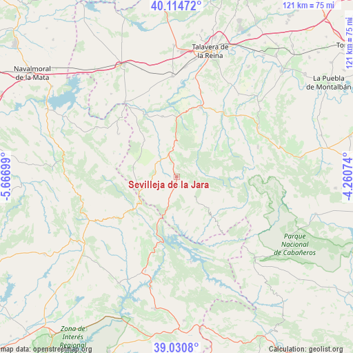
Sevilleja de la Jara GPS coordinates[2]
39° 34' 29.568" North, 4° 57' 49.932" West
| Map corner | latitude | longitude |
|---|---|---|
| Upper-left | 40.11472°, | -5.66699° |
| Center: | 39.57488°, | -4.96387° |
| Lower-right: | 39.0308°, | -4.26074° |
| Map W x H: | 120.5×120.5 km | = 74.9×74.9mi |
| max Lat: | 43.74134° ⇑76% North |
| Sevilleja de la Jara: | 39.57488° |
| min Lat: | ⇓24% South 27.64134° |
| min Long | Sevilleja de la | max Long |
| -18.00367° | -4.96387° | 4.2899° |
| W 28%⇐ | ⇒72% E |
Elevation
Elevation of Sevilleja de la Jara is 664 m = 2178 ft, and this is 66 m = 217 ft above average elevation for this country.
| Max E: |
1682 m = 5518 ft | 49.5% |
| Sevilleja de la Jara | 664 m 2178 ft | |
| Avg. | 598 m = 1962 ft | |
Min E: |
0 m = 0 ft | 50.5% |
See also: Spain elevation on elevation.city.
Geographical zone
Sevilleja de la Jara is located in North temperate zone (between Tropic of Cancer and the Arctic Circle). Distance of this Northern Tropic circle is 1794.4 km =1115 mi to South.| Distance of | km | miles | from Sevilleja de la Jara |
|---|---|---|---|
| North Pole | 5606.7 | 3483.8 | to North |
| Arctic Circle | 3000.9 | 1864.7 | to North |
| Tropic Cancer | 1794.4 | 1115 | to South |
| Equator | 4400.3 | 2734.2 | to South |


Nearby cities:
15 places around Sevilleja de la Jara: (largest is in red/bold)
• Aldeanueva de Barbarroya
21.1 km =13.1 mi,  346°
346°
• Aldeanueva de San Bartolomé
14.5 km =9 mi,  298°
298°
• Alía
25.9 km =16.1 mi,  237°
237°
• Anchuras
15.3 km =9.5 mi,  133°
133°
• Azután
27.3 km =17 mi,  329°
329°
• Belvis de la Jara
20.4 km =12.7 mi,  3°
3°
• Carrascalejo
22.6 km =14 mi,  286°
286°
• Espinoso del Rey
17.7 km =11 mi,  60°
60°
• La Nava de Ricomalillo
8.6 km =5.3 mi,  344°
344°
• Mohedas de la Jara
15.6 km =9.7 mi,  282°
282°
• Navalmoralejo
23.9 km =14.9 mi,  319°
319°
• Puerto de San Vicente
14.1 km =8.8 mi,  245°
245°
• Rosalejo
16.1 km =10 mi,  162°
162°
• Torrecilla de la Jara
21.8 km =13.5 mi,  48°
48°
• Villar del Pedroso
24.7 km =15.3 mi,  306°
306°
Sources, notices
• [Note1] Compared only with cities in Spain existing in our database
• [Src1] Map data: © OpenStreetMap contributors (CC-BY-SA)
• [Src2] Other city data from geonames.org with taken over terms of usage.
• [Src3] Geographical zone / Annual Mean Temperature by Robert A. Rohde @ Wikipedia
