Benacazón geodata
Benacazón (Andalusia) is a seat of a third-order administrative division; located in Spain in Europe/Madrid (GMT+2) time zone. With population of 5,698 people, there are 1175 cities with bigger population in this country. Compared to other cities in Spain, 92.4% of cities are located further ↑North; 88.5% of cities are located further →East and 86.1% of cities have higher elevation than Benacazón. Note1


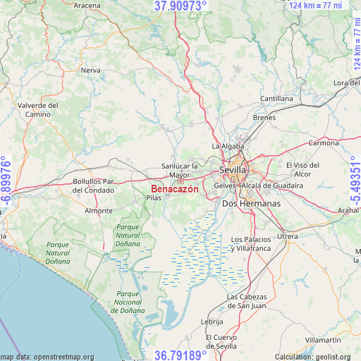
Benacazón GPS coordinates[2]
37° 21' 10.404" North, 6° 11' 47.868" West
| Map corner | latitude | longitude |
|---|---|---|
| Upper-left | 37.90973°, | -6.89976° |
| Center: | 37.35289°, | -6.19663° |
| Lower-right: | 36.79189°, | -5.49351° |
| Map W x H: | 124.3×124.3 km | = 77.2×77.2mi |
| max Lat: | 43.74134° ⇑92.4% North |
| Benacazón: | 37.35289° |
| min Lat: | ⇓7.6% South 27.64134° |
| min Long | Benacazón | max Long |
| -18.00367° | -6.19663° | 4.2899° |
| W 11.5%⇐ | ⇒88.5% E |
Elevation
Elevation of Benacazón is 120 m = 394 ft, and this is 478 m = 1568 ft below average elevation for this country.
| Max E: |
1682 m = 5518 ft | 86.1% |
| Avg. | 598 m = 1962 ft | |
| Benacazón | 120 m = 394 ft | |
Min E: |
0 m = 0 ft | 13.9% |
See also: Spain elevation on elevation.city.
Geographical zone
Benacazón is located in North temperate zone (between Tropic of Cancer and the Arctic Circle). Distance of this Northern Tropic circle is 1547.3 km =961.4 mi to South.| Distance of | km | miles | from Benacazón |
|---|---|---|---|
| North Pole | 5853.8 | 3637.4 | to North |
| Arctic Circle | 3247.9 | 2018.2 | to North |
| Tropic Cancer | 1547.3 | 961.4 | to South |
| Equator | 4153.3 | 2580.7 | to South |


Nearby cities:
15 places around Benacazón: (largest is in red/bold)
• Albaida del Aljarafe
8.3 km =5.2 mi,  18°
18°
• Almensilla
9 km =5.6 mi,  121°
121°
• Aznalcázar
7.2 km =4.5 mi,  220°
220°
• Bollullos de la Mitación
5.4 km =3.4 mi,  105°
105°
• Bormujos
11.2 km =7 mi,  78°
78°
• Carrión de los Céspedes
11.9 km =7.4 mi,  279°
279°
• Espartinas
7 km =4.3 mi,  63°
63°
• Gines
11.2 km =7 mi,  70°
70°
• Mairena del Aljarafe
11.8 km =7.3 mi,  94°
94°
• Olivares
8.1 km =5 mi,  26°
26°
• Pilas
10.7 km =6.6 mi,  239°
239°
• Salteras
10.7 km =6.6 mi,  45°
45°
• Sanlúcar la Mayor
3.9 km =2.4 mi,  351°
351°
• Umbrete
3.8 km =2.4 mi, 62°
• Villanueva del Ariscal
6.9 km =4.3 mi, 45°
Sources, notices
• [Note1] Compared only with cities in Spain existing in our database
• [Src1] Map data: © OpenStreetMap contributors (CC-BY-SA)
• [Src2] Other city data from geonames.org with taken over terms of usage.
• [Src3] Geographical zone / Annual Mean Temperature by Robert A. Rohde @ Wikipedia
