Almodóvar del Pinar geodata
Almodóvar del Pinar (Castille-La Mancha) is a seat of a third-order administrative division; located in Spain in Europe/Madrid (GMT+2) time zone. With population of 512 people, there are 3849 cities with bigger population in this country. Compared to other cities in Spain, 74.1% of cities are located further ↑North; 68.7% of cities are located further ←West and 87.3% of cities have lower elevation than Almodóvar del Pinar. Note1
Administrative division(s):
- Level 1: Castille-La Mancha
- Level 2: Provincia de Cuenca
- Level 3: Almodóvar del Pinar


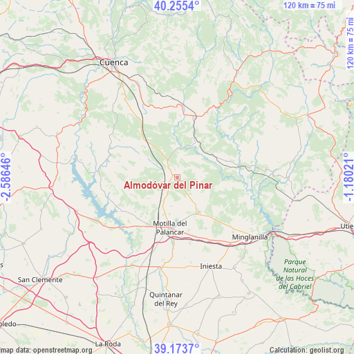
Almodóvar del Pinar GPS coordinates[2]
39° 43' 0.012" North, 1° 52' 59.988" West
| Map corner | latitude | longitude |
|---|---|---|
| Upper-left | 40.2554°, | -2.58646° |
| Center: | 39.71667°, | -1.88333° |
| Lower-right: | 39.1737°, | -1.18021° |
| Map W x H: | 120.3×120.3 km | = 74.8×74.8mi |
| max Lat: | 43.74134° ⇑74.1% North |
| Almodóvar del Pinar: | 39.71667° |
| min Lat: | ⇓25.9% South 27.64134° |
| min Long | Almodóvar del | max Long |
| -18.00367° | -1.88333° | 4.2899° |
| W 68.7%⇐ | ⇒31.3% E |
Elevation
Elevation of Almodóvar del Pinar is 986 m = 3235 ft, and this is 388 m = 1273 ft above average elevation for this country.
| Max E: |
1682 m = 5518 ft | 12.7% |
| Almodóvar del Pinar | 986 m 3235 ft | |
| Avg. | 598 m = 1962 ft | |
Min E: |
0 m = 0 ft | 87.3% |
See also: Spain elevation on elevation.city.
Geographical zone
Almodóvar del Pinar is located in North temperate zone (between Tropic of Cancer and the Arctic Circle). Distance of this Northern Tropic circle is 1810.2 km =1124.8 mi to South.| Distance of | km | miles | from Almodóvar del Pinar |
|---|---|---|---|
| North Pole | 5591 | 3474.1 | to North |
| Arctic Circle | 2985.1 | 1854.9 | to North |
| Tropic Cancer | 1810.2 | 1124.8 | to South |
| Equator | 4416.1 | 2744 | to South |


Nearby cities:
15 places around Almodóvar del Pinar: (largest is in red/bold)
• Arguisuelas
14.2 km =8.8 mi,  23°
23°
• Barchín del Hoyo
16.6 km =10.3 mi,  250°
250°
• Campillo de Altobuey
14.8 km =9.2 mi,  151°
151°
• Carboneras de Guadazaón
19.9 km =12.4 mi, 21°
• Cardenete
18 km =11.2 mi,  71°
71°
• Chumillas
14 km =8.7 mi,  293°
293°
• Gabaldón
11.9 km =7.4 mi,  201°
201°
• Monteagudo de las Salinas
9.4 km =5.8 mi,  351°
351°
• Motilla del Palancar
16.7 km =10.4 mi,  180°
180°
• Olmeda del Rey
19.4 km =12.1 mi,  298°
298°
• Paracuellos
8.6 km =5.3 mi,  90°
90°
• Piqueras del Castillo
15.7 km =9.8 mi,  270°
270°
• Valhermoso de la Fuente
20.2 km =12.6 mi,  214°
214°
• Valverdejo
15.9 km =9.9 mi,  225°
225°
• Yémeda
15.3 km =9.5 mi, 68°
Sources, notices
• [Note1] Compared only with cities in Spain existing in our database
• [Src1] Map data: © OpenStreetMap contributors (CC-BY-SA)
• [Src2] Other city data from geonames.org with taken over terms of usage.
• [Src3] Geographical zone / Annual Mean Temperature by Robert A. Rohde @ Wikipedia
