Paracuellos geodata
Paracuellos (Castille-La Mancha) is a seat of a third-order administrative division; located in Spain in Europe/Madrid (GMT+2) time zone. With population of 157 people, there are 5369 cities with bigger population in this country. Compared to other cities in Spain, 74.1% of cities are located further ↑North; 69.7% of cities are located further ←West and 82.5% of cities have lower elevation than Paracuellos. Note1
Administrative division(s):
- Level 1: Castille-La Mancha
- Level 2: Provincia de Cuenca
- Level 3: Paracuellos


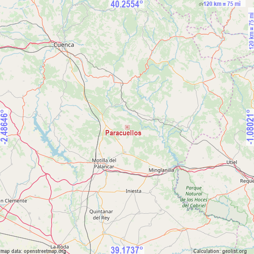
Paracuellos GPS coordinates[2]
39° 43' 0.012" North, 1° 46' 59.988" West
| Map corner | latitude | longitude |
|---|---|---|
| Upper-left | 40.2554°, | -2.48646° |
| Center: | 39.71667°, | -1.78333° |
| Lower-right: | 39.1737°, | -1.08021° |
| Map W x H: | 120.3×120.3 km | = 74.8×74.8mi |
| max Lat: | 43.74134° ⇑74.1% North |
| Paracuellos: | 39.71667° |
| min Lat: | ⇓25.9% South 27.64134° |
| min Long | Paracuellos | max Long |
| -18.00367° | -1.78333° | 4.2899° |
| W 69.7%⇐ | ⇒30.3% E |
Elevation
Elevation of Paracuellos is 922 m = 3025 ft, and this is 324 m = 1063 ft above average elevation for this country.
| Max E: |
1682 m = 5518 ft | 17.5% |
| Paracuellos | 922 m 3025 ft | |
| Avg. | 598 m = 1962 ft | |
Min E: |
0 m = 0 ft | 82.5% |
See also: Spain elevation on elevation.city.
Geographical zone
Paracuellos is located in North temperate zone (between Tropic of Cancer and the Arctic Circle). Distance of this Northern Tropic circle is 1810.2 km =1124.8 mi to South.| Distance of | km | miles | from Paracuellos |
|---|---|---|---|
| North Pole | 5591 | 3474.1 | to North |
| Arctic Circle | 2985.1 | 1854.9 | to North |
| Tropic Cancer | 1810.2 | 1124.8 | to South |
| Equator | 4416.1 | 2744 | to South |


Nearby cities:
15 places around Paracuellos: (largest is in red/bold)
• Almodóvar del Pinar
8.6 km =5.3 mi,  270°
270°
• Arguisuelas
13.3 km =8.3 mi,  347°
347°
• Campillo de Altobuey
13.1 km =8.1 mi,  186°
186°
• Carboneras de Guadazaón
18.6 km =11.6 mi,  355°
355°
• Cardenete
10.2 km =6.3 mi,  56°
56°
• Castillejo de Iniesta
20.4 km =12.7 mi,  175°
175°
• Chumillas
22.1 km =13.7 mi,  284°
284°
• Enguídanos
16.6 km =10.3 mi,  109°
109°
• Gabaldón
17 km =10.6 mi,  229°
229°
• Monteagudo de las Salinas
13.6 km =8.5 mi,  312°
312°
• Motilla del Palancar
18.7 km =11.6 mi,  207°
207°
• Puebla del Salvador
19.4 km =12.1 mi,  149°
149°
• Reíllo
21.6 km =13.4 mi,  340°
340°
• Villar del Humo
21 km =13 mi,  37°
37°
• Yémeda
8 km =5 mi,  45°
45°
Sources, notices
• [Note1] Compared only with cities in Spain existing in our database
• [Src1] Map data: © OpenStreetMap contributors (CC-BY-SA)
• [Src2] Other city data from geonames.org with taken over terms of usage.
• [Src3] Geographical zone / Annual Mean Temperature by Robert A. Rohde @ Wikipedia
