Villar de Ciervo geodata
Villar de Ciervo (Castille and León) is a seat of a third-order administrative division; located in Spain in Europe/Madrid (GMT+2) time zone. With population of 349 people, there are 4317 cities with bigger population in this country. Compared to other cities in Spain, 57.3% of cities are located further ↑North; 93.1% of cities are located further →East and 52.6% of cities have lower elevation than Villar de Ciervo. Note1
Administrative division(s):
- Level 1: Castille and León
- Level 2: Provincia de Salamanca
- Level 3: Villar de Ciervo


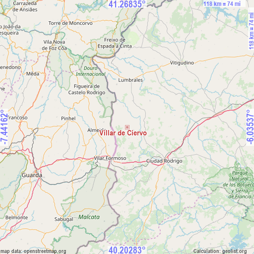
Villar de Ciervo GPS coordinates[2]
40° 44' 15.792" North, 6° 44' 18.6" West
| Map corner | latitude | longitude |
|---|---|---|
| Upper-left | 41.26835°, | -7.44162° |
| Center: | 40.73772°, | -6.7385° |
| Lower-right: | 40.20283°, | -6.03537° |
| Map W x H: | 118.5×118.5 km | = 73.6×73.6mi |
| max Lat: | 43.74134° ⇑57.3% North |
| Villar de Ciervo: | 40.73772° |
| min Lat: | ⇓42.7% South 27.64134° |
| min Long | Villar de Cierv | max Long |
| -18.00367° | -6.7385° | 4.2899° |
| W 6.9%⇐ | ⇒93.1% E |
Elevation
Elevation of Villar de Ciervo is 686 m = 2251 ft, and this is 88 m = 289 ft above average elevation for this country.
| Max E: |
1682 m = 5518 ft | 47.4% |
| Villar de Ciervo | 686 m 2251 ft | |
| Avg. | 598 m = 1962 ft | |
Min E: |
0 m = 0 ft | 52.6% |
See also: Spain elevation on elevation.city.
Geographical zone
Villar de Ciervo is located in North temperate zone (between Tropic of Cancer and the Arctic Circle). Distance of this Northern Tropic circle is 1923.7 km =1195.3 mi to South.| Distance of | km | miles | from Villar de Ciervo |
|---|---|---|---|
| North Pole | 5477.5 | 3403.6 | to North |
| Arctic Circle | 2871.6 | 1784.3 | to North |
| Tropic Cancer | 1923.7 | 1195.3 | to South |
| Equator | 4529.6 | 2814.6 | to South |


Nearby cities:
15 places around Villar de Ciervo: (largest is in red/bold)
• Ahigal de los Aceiteros
15 km =9.3 mi,  357°
357°
• Aldea del Obispo
5.7 km =3.5 mi,  232°
232°
• Bañobárez
16.2 km =10.1 mi,  40°
40°
• Carpio de Azaba
17.6 km =10.9 mi,  153°
153°
• Castillejo de Martín Viejo
9.6 km =6 mi,  117°
117°
• Espeja
19.2 km =11.9 mi,  174°
174°
• Fuentes de Oñoro
17.4 km =10.8 mi,  200°
200°
• Gallegos de Argañán
12.2 km =7.6 mi, 165°
• La Bouza
12 km =7.5 mi,  336°
336°
• Olmedo de Camaces
18.5 km =11.5 mi,  31°
31°
• Puerto Seguro
10.1 km =6.3 mi,  349°
349°
• Saelices el Chico
11.7 km =7.3 mi,  130°
130°
• San Felices de los Gallegos
12.7 km =7.9 mi,  11°
11°
• Sobradillo
20.6 km =12.8 mi, 346°
• Villar de la Yegua
3.2 km =2 mi,  114°
114°
Sources, notices
• [Note1] Compared only with cities in Spain existing in our database
• [Src1] Map data: © OpenStreetMap contributors (CC-BY-SA)
• [Src2] Other city data from geonames.org with taken over terms of usage.
• [Src3] Geographical zone / Annual Mean Temperature by Robert A. Rohde @ Wikipedia
