Villanueva de la Torre geodata
Villanueva de la Torre (Castille-La Mancha) is a seat of a third-order administrative division; located in Spain in Europe/Madrid (GMT+2) time zone. With population of 4,892 people, there are 1329 cities with bigger population in this country. Compared to other cities in Spain, 60.2% of cities are located further ↑North; 50.5% of cities are located further ←West and 54.8% of cities have lower elevation than Villanueva de la Torre. Note1
Administrative division(s):
- Level 1: Castille-La Mancha
- Level 2: Provincia de Guadalajara
- Level 3: Villanueva de la Torre
Current local time in Villanueva de la Torre:
09:17 PM, ThursdayDifference from your time zone: hours


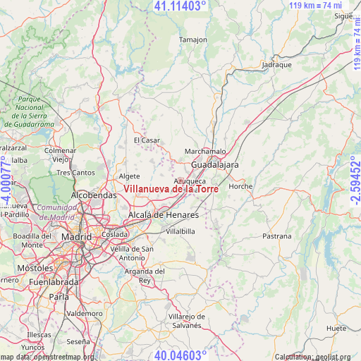
Villanueva de la Torre GPS coordinates[2]
40° 34' 55.776" North, 3° 17' 51.504" West
| Map corner | latitude | longitude |
|---|---|---|
| Upper-left | 41.11403°, | -4.00077° |
| Center: | 40.58216°, | -3.29764° |
| Lower-right: | 40.04603°, | -2.59452° |
| Map W x H: | 118.8×118.8 km | = 73.8×73.8mi |
| max Lat: | 43.74134° ⇑60.2% North |
| Villanueva de la Torre: | 40.58216° |
| min Lat: | ⇓39.8% South 27.64134° |
| min Long | Villanueva de l | max Long |
| -18.00367° | -3.29764° | 4.2899° |
| W 50.5%⇐ | ⇒49.5% E |
Elevation
Elevation of Villanueva de la Torre is 708 m = 2323 ft, and this is 110 m = 361 ft above average elevation for this country.
| Max E: |
1682 m = 5518 ft | 45.2% |
| Villanueva de la Torre | 708 m 2323 ft | |
| Avg. | 598 m = 1962 ft | |
Min E: |
0 m = 0 ft | 54.8% |
See also: Spain elevation on elevation.city.
Geographical zone
Villanueva de la Torre is located in North temperate zone (between Tropic of Cancer and the Arctic Circle). Distance of this Northern Tropic circle is 1906.4 km =1184.6 mi to South.| Distance of | km | miles | from Villanueva de la Torre |
|---|---|---|---|
| North Pole | 5494.7 | 3414.2 | to North |
| Arctic Circle | 2888.9 | 1795.1 | to North |
| Tropic Cancer | 1906.4 | 1184.6 | to South |
| Equator | 4512.3 | 2803.8 | to South |


Nearby cities:
15 places around Villanueva de la Torre: (largest is in red/bold)
• Alcalá de Henares
12.3 km =7.6 mi,  205°
205°
• Alovera
4.6 km =2.9 mi,  73°
73°
• Azuqueca de Henares
3.1 km =1.9 mi,  125°
125°
• Cabanillas del Campo
8.1 km =5 mi,  45°
45°
• Camarma de Esteruelas
7.3 km =4.5 mi,  240°
240°
• Chiloeches
11.7 km =7.3 mi,  96°
96°
• Fresno de Torote
9.5 km =5.9 mi,  275°
275°
• Los Santos de la Humosa
9.9 km =6.2 mi,  157°
157°
• Marchamalo
12.6 km =7.8 mi,  41°
41°
• Meco
4.2 km =2.6 mi,  218°
218°
• Quer
3.2 km =2 mi, 36°
• Ribatejada
12 km =7.5 mi,  319°
319°
• Torrejón del Rey
7.4 km =4.6 mi,  335°
335°
• Valdeavero
6 km =3.7 mi,  332°
332°
• Valdeaveruelo
6 km =3.7 mi,  346°
346°
Sources, notices
• [Note1] Compared only with cities in Spain existing in our database
• [Src1] Map data: © OpenStreetMap contributors (CC-BY-SA)
• [Src2] Other city data from geonames.org with taken over terms of usage.
• [Src3] Geographical zone / Annual Mean Temperature by Robert A. Rohde @ Wikipedia
