Chiloeches geodata
Chiloeches (Castille-La Mancha) is a seat of a third-order administrative division; located in Spain in Europe/Madrid (GMT+2) time zone. With population of 1,791 people, there are 2293 cities with bigger population in this country. Compared to other cities in Spain, 60.4% of cities are located further ↑North; 52.1% of cities are located further ←West and 75.6% of cities have lower elevation than Chiloeches. Note1
Administrative division(s):
- Level 1: Castille-La Mancha
- Level 2: Provincia de Guadalajara
- Level 3: Chiloeches


Chiloeches GPS coordinates[2]
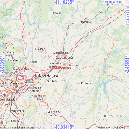
40° 34' 13.368" North, 3° 9' 36.108" West
| Map corner | latitude | longitude |
|---|---|---|
| Upper-left | 41.10235°, | -3.86316° |
| Center: | 40.57038°, | -3.16003° |
| Lower-right: | 40.03415°, | -2.45691° |
| Map W x H: | 118.8×118.8 km | = 73.8×73.8mi |
| max Lat: | 43.74134° ⇑60.4% North |
| Chiloeches: | 40.57038° |
| min Lat: | ⇓39.6% South 27.64134° |
| min Long | Chiloeches | max Long |
| -18.00367° | -3.16003° | 4.2899° |
| W 52.1%⇐ | ⇒47.9% E |
Elevation
Elevation of Chiloeches is 857 m = 2812 ft, and this is 259 m = 850 ft above average elevation for this country.
| Max E: |
1682 m = 5518 ft | 24.4% |
| Chiloeches | 857 m 2812 ft | |
| Avg. | 598 m = 1962 ft | |
Min E: |
0 m = 0 ft | 75.6% |
See also: Spain elevation on elevation.city.
Geographical zone
Chiloeches is located in North temperate zone (between Tropic of Cancer and the Arctic Circle). Distance of this Northern Tropic circle is 1905.1 km =1183.8 mi to South.| Distance of | km | miles | from Chiloeches |
|---|---|---|---|
| North Pole | 5496.1 | 3415.1 | to North |
| Arctic Circle | 2890.2 | 1795.9 | to North |
| Tropic Cancer | 1905.1 | 1183.8 | to South |
| Equator | 4511 | 2803 | to South |


Nearby cities:
15 places around Chiloeches: (largest is in red/bold)
• Alovera
7.7 km =4.8 mi,  289°
289°
• Aranzueque
11.4 km =7.1 mi,  140°
140°
• Armuña de Tajuña
12.1 km =7.5 mi,  112°
112°
• Azuqueca de Henares
9.1 km =5.7 mi,  266°
266°
• Cabanillas del Campo
9.2 km =5.7 mi,  320°
320°
• Guadalajara
6.5 km =4 mi,  358°
358°
• Horche
8.4 km =5.2 mi,  94°
94°
• Los Santos de la Humosa
11.1 km =6.9 mi,  225°
225°
• Lupiana
10.1 km =6.3 mi,  65°
65°
• Marchamalo
11.2 km =7 mi,  342°
342°
• Pozo de Guadalajara
8.5 km =5.3 mi,  192°
192°
• Quer
10.5 km =6.5 mi, 291°
• Valdarachas
6.6 km =4.1 mi,  154°
154°
• Villanueva de la Torre
11.7 km =7.3 mi,  276°
276°
• Yebes
6.2 km =3.9 mi,  134°
134°
Sources, notices
• [Note1] Compared only with cities in Spain existing in our database
• [Src1] Map data: © OpenStreetMap contributors (CC-BY-SA)
• [Src2] Other city data from geonames.org with taken over terms of usage.
• [Src3] Geographical zone / Annual Mean Temperature by Robert A. Rohde @ Wikipedia
