Villada geodata
Villada (Castille and León) is a seat of a third-order administrative division; located in Spain in Europe/Madrid (GMT+2) time zone. With population of 1,165 people, there are 2760 cities with bigger population in this country. Compared to other cities in Spain, 80.6% of cities are located further ↓South; 72.1% of cities are located further →East and 68.4% of cities have lower elevation than Villada. Note1
Administrative division(s):
- Level 1: Castille and León
- Level 2: Provincia de Palencia
- Level 3: Villada


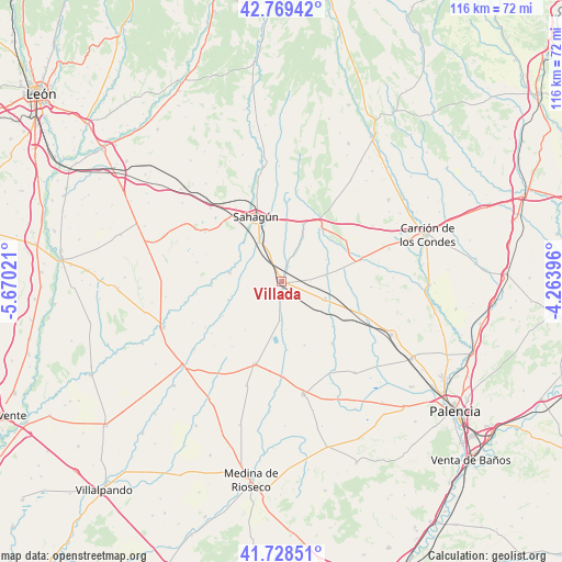
Villada GPS coordinates[2]
42° 15' 3.996" North, 4° 58' 1.488" West
| Map corner | latitude | longitude |
|---|---|---|
| Upper-left | 42.76942°, | -5.67021° |
| Center: | 42.25111°, | -4.96708° |
| Lower-right: | 41.72851°, | -4.26396° |
| Map W x H: | 115.7×115.7 km | = 71.9×71.9mi |
| max Lat: | 43.74134° ⇑19.4% North |
| Villada: | 42.25111° |
| min Lat: | ⇓80.6% South 27.64134° |
| min Long | Villada | max Long |
| -18.00367° | -4.96708° | 4.2899° |
| W 27.9%⇐ | ⇒72.1% E |
Elevation
Elevation of Villada is 801 m = 2628 ft, and this is 203 m = 666 ft above average elevation for this country.
| Max E: |
1682 m = 5518 ft | 31.6% |
| Villada | 801 m 2628 ft | |
| Avg. | 598 m = 1962 ft | |
Min E: |
0 m = 0 ft | 68.4% |
See also: Spain elevation on elevation.city.
Geographical zone
Villada is located in North temperate zone (between Tropic of Cancer and the Arctic Circle). Distance of this Northern Tropic circle is 2092 km =1299.9 mi to South.| Distance of | km | miles | from Villada |
|---|---|---|---|
| North Pole | 5309.2 | 3299 | to North |
| Arctic Circle | 2703.3 | 1679.8 | to North |
| Tropic Cancer | 2092 | 1299.9 | to South |
| Equator | 4697.9 | 2919.1 | to South |


Nearby cities:
15 places around Villada: (largest is in red/bold)
• Cisneros
9.6 km =6 mi,  110°
110°
• Escobar de Campos
6.9 km =4.3 mi,  0°
0°
• Fontihoyuelo
12.4 km =7.7 mi,  217°
217°
• Grajal de Campos
8.9 km =5.5 mi,  330°
330°
• Guaza de Campos
13.9 km =8.6 mi,  160°
160°
• Mazuecos de Valdeginate
13.9 km =8.6 mi,  131°
131°
• Melgar de Arriba
10.9 km =6.8 mi,  279°
279°
• Moratinos
12.7 km =7.9 mi,  14°
14°
• Población de Arroyo
12.2 km =7.6 mi,  38°
38°
• Pozo de Urama
6 km =3.7 mi,  86°
86°
• San Román de la Cuba
9.1 km =5.7 mi,  81°
81°
• Santervás de Campos
11.6 km =7.2 mi,  251°
251°
• Villacarralón
9.2 km =5.7 mi, 222°
• Villacidaler
3.4 km =2.1 mi,  193°
193°
• Villalcón
10.3 km =6.4 mi,  63°
63°
Sources, notices
• [Note1] Compared only with cities in Spain existing in our database
• [Src1] Map data: © OpenStreetMap contributors (CC-BY-SA)
• [Src2] Other city data from geonames.org with taken over terms of usage.
• [Src3] Geographical zone / Annual Mean Temperature by Robert A. Rohde @ Wikipedia
