Grajal de Campos geodata
Grajal de Campos (Castille and León) is a seat of a third-order administrative division; located in Spain in Europe/Madrid (GMT+2) time zone. With population of 275 people, there are 4603 cities with bigger population in this country. Compared to other cities in Spain, 82.4% of cities are located further ↓South; 72.7% of cities are located further →East and 68.9% of cities have lower elevation than Grajal de Campos. Note1
Administrative division(s):
- Level 1: Castille and León
- Level 2: Provincia de León
- Level 3: Grajal de Campos


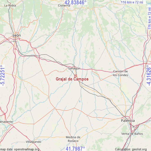
Grajal de Campos GPS coordinates[2]
42° 19' 14.628" North, 5° 1' 9.768" West
| Map corner | latitude | longitude |
|---|---|---|
| Upper-left | 42.83846°, | -5.72251° |
| Center: | 42.32073°, | -5.01938° |
| Lower-right: | 41.7987°, | -4.31626° |
| Map W x H: | 115.6×115.6 km | = 71.8×71.8mi |
| max Lat: | 43.74134° ⇑17.6% North |
| Grajal de Campos: | 42.32073° |
| min Lat: | ⇓82.4% South 27.64134° |
| min Long | Grajal de Campo | max Long |
| -18.00367° | -5.01938° | 4.2899° |
| W 27.3%⇐ | ⇒72.7% E |
Elevation
Elevation of Grajal de Campos is 805 m = 2641 ft, and this is 207 m = 679 ft above average elevation for this country.
| Max E: |
1682 m = 5518 ft | 31.1% |
| Grajal de Campos | 805 m 2641 ft | |
| Avg. | 598 m = 1962 ft | |
Min E: |
0 m = 0 ft | 68.9% |
See also: Spain elevation on elevation.city.
Geographical zone
Grajal de Campos is located in North temperate zone (between Tropic of Cancer and the Arctic Circle). Distance of this Northern Tropic circle is 2099.7 km =1304.7 mi to South.| Distance of | km | miles | from Grajal de Campos |
|---|---|---|---|
| North Pole | 5301.4 | 3294.1 | to North |
| Arctic Circle | 2695.6 | 1675 | to North |
| Tropic Cancer | 2099.7 | 1304.7 | to South |
| Equator | 4705.6 | 2923.9 | to South |


Nearby cities:
15 places around Grajal de Campos: (largest is in red/bold)
• Bercianos del Real Camino
12.7 km =7.9 mi,  305°
305°
• Calzada del Coto
8.7 km =5.4 mi,  326°
326°
• Escobar de Campos
4.5 km =2.8 mi,  100°
100°
• Gordaliza del Pino
11.6 km =7.2 mi,  282°
282°
• Ledigos
13.3 km =8.3 mi,  73°
73°
• Melgar de Abajo
13.3 km =8.3 mi,  229°
229°
• Melgar de Arriba
8.7 km =5.4 mi, 227°
• Moratinos
8.8 km =5.5 mi,  58°
58°
• Población de Arroyo
12.1 km =7.5 mi,  81°
81°
• Pozo de Urama
12.7 km =7.9 mi,  125°
125°
• Sahagún
5.6 km =3.5 mi,  351°
351°
• Santervás de Campos
13.2 km =8.2 mi,  210°
210°
• Villacidaler
11.6 km =7.2 mi,  162°
162°
• Villada
8.9 km =5.5 mi,  150°
150°
• Villamol
12.1 km =7.5 mi, 348°
Sources, notices
• [Note1] Compared only with cities in Spain existing in our database
• [Src1] Map data: © OpenStreetMap contributors (CC-BY-SA)
• [Src2] Other city data from geonames.org with taken over terms of usage.
• [Src3] Geographical zone / Annual Mean Temperature by Robert A. Rohde @ Wikipedia
