Moratinos geodata
Moratinos (Castille and León) is a seat of a third-order administrative division; located in Spain in Europe/Madrid (GMT+2) time zone. With population of 76 people, there are 6179 cities with bigger population in this country. Compared to other cities in Spain, 83.6% of cities are located further ↓South; 71.5% of cities are located further →East and 76% of cities have lower elevation than Moratinos. Note1
Administrative division(s):
- Level 1: Castille and León
- Level 2: Provincia de Palencia
- Level 3: Moratinos


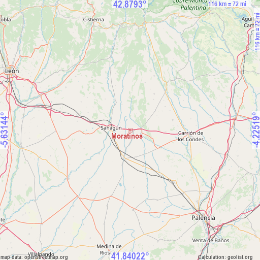
Moratinos GPS coordinates[2]
42° 21' 42.876" North, 4° 55' 41.916" West
| Map corner | latitude | longitude |
|---|---|---|
| Upper-left | 42.8793°, | -5.63144° |
| Center: | 42.36191°, | -4.92831° |
| Lower-right: | 41.84022°, | -4.22519° |
| Map W x H: | 115.5×115.5 km | = 71.8×71.8mi |
| max Lat: | 43.74134° ⇑16.4% North |
| Moratinos: | 42.36191° |
| min Lat: | ⇓83.6% South 27.64134° |
| min Long | Moratinos | max Long |
| -18.00367° | -4.92831° | 4.2899° |
| W 28.5%⇐ | ⇒71.5% E |
Elevation
Elevation of Moratinos is 860 m = 2822 ft, and this is 262 m = 860 ft above average elevation for this country.
| Max E: |
1682 m = 5518 ft | 24% |
| Moratinos | 860 m 2822 ft | |
| Avg. | 598 m = 1962 ft | |
Min E: |
0 m = 0 ft | 76% |
See also: Spain elevation on elevation.city.
Geographical zone
Moratinos is located in North temperate zone (between Tropic of Cancer and the Arctic Circle). Distance of this Northern Tropic circle is 2104.3 km =1307.6 mi to South.| Distance of | km | miles | from Moratinos |
|---|---|---|---|
| North Pole | 5296.9 | 3291.3 | to North |
| Arctic Circle | 2691 | 1672.1 | to North |
| Tropic Cancer | 2104.3 | 1307.6 | to South |
| Equator | 4710.2 | 2926.8 | to South |


Nearby cities:
15 places around Moratinos: (largest is in red/bold)
• Calzada del Coto
12.6 km =7.8 mi,  282°
282°
• Cea
13.1 km =8.1 mi,  328°
328°
• Cervatos de la Cueza
15.3 km =9.5 mi,  121°
121°
• Escobar de Campos
6.2 km =3.9 mi,  209°
209°
• Grajal de Campos
8.8 km =5.5 mi,  238°
238°
• Lagartos
5.3 km =3.3 mi,  21°
21°
• Ledigos
5.3 km =3.3 mi,  98°
98°
• Población de Arroyo
5.3 km =3.3 mi, 122°
• Pozo de Urama
12.3 km =7.6 mi,  166°
166°
• Sahagún
8.4 km =5.2 mi, 276°
• San Román de la Cuba
12.5 km =7.8 mi,  152°
152°
• Villada
12.7 km =7.9 mi,  194°
194°
• Villalcón
9.7 km =6 mi,  141°
141°
• Villamol
12.3 km =7.6 mi,  306°
306°
• Villarrabé
13.5 km =8.4 mi,  60°
60°
Sources, notices
• [Note1] Compared only with cities in Spain existing in our database
• [Src1] Map data: © OpenStreetMap contributors (CC-BY-SA)
• [Src2] Other city data from geonames.org with taken over terms of usage.
• [Src3] Geographical zone / Annual Mean Temperature by Robert A. Rohde @ Wikipedia
