Vila-sacra geodata
Vila-sacra (Catalonia) is a seat of a third-order administrative division; located in Spain in Europe/Madrid (GMT+2) time zone. In our database, there are 6762 cities with bigger population. Compared to other cities in Spain, 81% of cities are located further ↓South; 98.8% of cities are located further ←West and 97% of cities have higher elevation than Vila-sacra. Note1


Vila-sacra GPS coordinates[2]
42° 15' 56.808" North, 3° 1' 6.204" East
| Map corner | latitude | longitude |
|---|---|---|
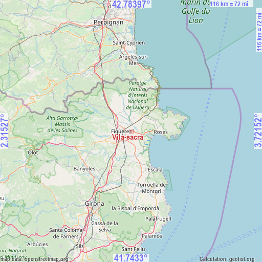
| Upper-left | 42.78397°, | 2.31527° |
| Center: | 42.26578°, | 3.01839° |
| Lower-right: | 41.7433°, | 3.72152° |
| Map W x H: | 115.7×115.7 km | = 71.9×71.9mi |
| max Lat: | 43.74134° ⇑19% North |
| Vila-sacra: | 42.26578° |
| min Lat: | ⇓81% South 27.64134° |
| min Long | Vila-sacra | max Long |
| -18.00367° | 3.01839° | 4.2899° |
| W 98.8%⇐ | ⇒1.2% E |
Elevation
Elevation of Vila-sacra is 15 m = 49 ft, and this is 583 m = 1913 ft below average elevation for this country.
| Max E: |
1682 m = 5518 ft | 97% |
| Avg. | 598 m = 1962 ft | |
| Vila-sacra | 15 m = 49 ft | |
Min E: |
0 m = 0 ft | 3% |
See also: Spain elevation on elevation.city.
Geographical zone
Vila-sacra is located in North temperate zone (between Tropic of Cancer and the Arctic Circle). Distance of this Northern Tropic circle is 2093.6 km =1300.9 mi to South.| Distance of | km | miles | from Vila-sacra |
|---|---|---|---|
| North Pole | 5307.5 | 3297.9 | to North |
| Arctic Circle | 2701.7 | 1678.8 | to North |
| Tropic Cancer | 2093.6 | 1300.9 | to South |
| Equator | 4699.5 | 2920.1 | to South |


Nearby cities:
15 places around Vila-sacra: (largest is in red/bold)
• Avinyonet de Puigventós
8.7 km =5.4 mi,  258°
258°
• Borrassà
9 km =5.6 mi,  238°
238°
• Cabanes
5.8 km =3.6 mi,  324°
324°
• Castelló d'Empúries
4.7 km =2.9 mi,  102°
102°
• Empuriabrava
8.7 km =5.4 mi, 104°
• Figueres
4.7 km =2.9 mi,  270°
270°
• Fortià
3 km =1.9 mi,  146°
146°
• Peralada
4.8 km =3 mi,  350°
350°
• Riumors
4.7 km =2.9 mi,  155°
155°
• Siurana
6.6 km =4.1 mi,  197°
197°
• Vilabertran
3.6 km =2.2 mi,  301°
301°
• Vilafant
6.9 km =4.3 mi,  252°
252°
• Vilajuïga
9 km =5.6 mi,  42°
42°
• Vilamacolum
8.4 km =5.2 mi, 157°
• Vilamalla
6.7 km =4.2 mi,  216°
216°
Sources, notices
• [Note1] Compared only with cities in Spain existing in our database
• [Src1] Map data: © OpenStreetMap contributors (CC-BY-SA)
• [Src2] Other city data from geonames.org with taken over terms of usage.
• [Src3] Geographical zone / Annual Mean Temperature by Robert A. Rohde @ Wikipedia
