Velliza geodata
Velliza (Castille and León) is a seat of a third-order administrative division; located in Spain in Europe/Madrid (GMT+2) time zone. With population of 139 people, there are 5510 cities with bigger population in this country. Compared to other cities in Spain, 62.9% of cities are located further ↓South; 71.7% of cities are located further →East and 65% of cities have lower elevation than Velliza. Note1
Administrative division(s):
- Level 1: Castille and León
- Level 2: Provincia de Valladolid
- Level 3: Velliza


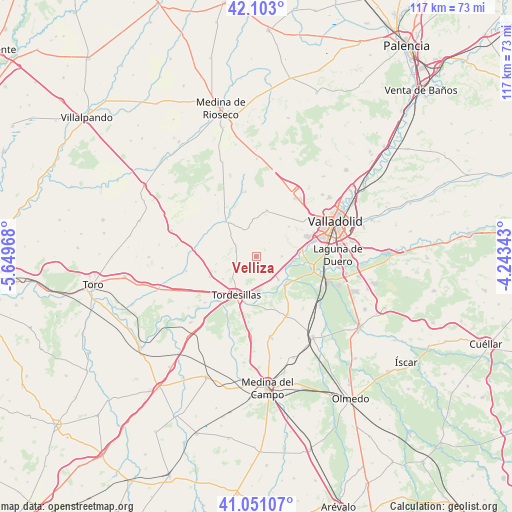
Velliza GPS coordinates[2]
41° 34' 45.048" North, 4° 56' 47.58" West
| Map corner | latitude | longitude |
|---|---|---|
| Upper-left | 42.103°, | -5.64968° |
| Center: | 41.57918°, | -4.94655° |
| Lower-right: | 41.05107°, | -4.24343° |
| Map W x H: | 117×117 km | = 72.7×72.7mi |
| max Lat: | 43.74134° ⇑37.1% North |
| Velliza: | 41.57918° |
| min Lat: | ⇓62.9% South 27.64134° |
| min Long | Velliza | max Long |
| -18.00367° | -4.94655° | 4.2899° |
| W 28.3%⇐ | ⇒71.7% E |
Elevation
Elevation of Velliza is 778 m = 2552 ft, and this is 180 m = 591 ft above average elevation for this country.
| Max E: |
1682 m = 5518 ft | 35% |
| Velliza | 778 m 2552 ft | |
| Avg. | 598 m = 1962 ft | |
Min E: |
0 m = 0 ft | 65% |
See also: Spain elevation on elevation.city.
Geographical zone
Velliza is located in North temperate zone (between Tropic of Cancer and the Arctic Circle). Distance of this Northern Tropic circle is 2017.3 km =1253.5 mi to South.| Distance of | km | miles | from Velliza |
|---|---|---|---|
| North Pole | 5383.9 | 3345.4 | to North |
| Arctic Circle | 2778 | 1726.2 | to North |
| Tropic Cancer | 2017.3 | 1253.5 | to South |
| Equator | 4623.2 | 2872.7 | to South |


Nearby cities:
15 places around Velliza: (largest is in red/bold)
• Bercero
9.2 km =5.7 mi,  259°
259°
• Berceruelo
7.2 km =4.5 mi,  271°
271°
• Castrodeza
7.9 km =4.9 mi,  352°
352°
• Ciguñuela
10.1 km =6.3 mi,  47°
47°
• Geria
5.8 km =3.6 mi,  90°
90°
• Matilla de los Caños
3.9 km =2.4 mi,  206°
206°
• Robladillo
4.5 km =2.8 mi,  43°
43°
• San Miguel del Pino
8.3 km =5.2 mi,  159°
159°
• Simancas
9.9 km =6.2 mi,  82°
82°
• Tordesillas
9.7 km =6 mi, 208°
• Torrelobatón
10.2 km =6.3 mi,  320°
320°
• Velilla
5.3 km =3.3 mi,  245°
245°
• Villanueva de Duero
9.4 km =5.8 mi,  134°
134°
• Villán de Tordesillas
2.6 km =1.6 mi, 52°
• Wamba
11 km =6.8 mi,  12°
12°
Sources, notices
• [Note1] Compared only with cities in Spain existing in our database
• [Src1] Map data: © OpenStreetMap contributors (CC-BY-SA)
• [Src2] Other city data from geonames.org with taken over terms of usage.
• [Src3] Geographical zone / Annual Mean Temperature by Robert A. Rohde @ Wikipedia
