Velascálvaro geodata
Velascálvaro (Castille and León) is a seat of a third-order administrative division; located in Spain in Europe/Madrid (GMT+2) time zone. With population of 188 people, there are 5123 cities with bigger population in this country. Compared to other cities in Spain, 54% of cities are located further ↓South; 72.2% of cities are located further →East and 60% of cities have lower elevation than Velascálvaro. Note1
Administrative division(s):
- Level 1: Castille and León
- Level 2: Provincia de Valladolid
- Level 3: Velascálvaro


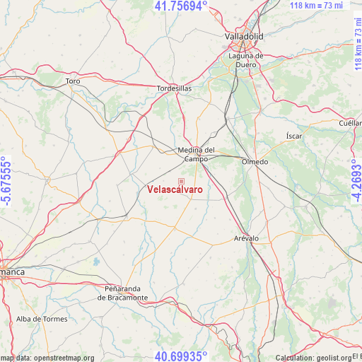
Velascálvaro GPS coordinates[2]
41° 13' 49.008" North, 4° 58' 20.712" West
| Map corner | latitude | longitude |
|---|---|---|
| Upper-left | 41.75694°, | -5.67555° |
| Center: | 41.23028°, | -4.97242° |
| Lower-right: | 40.69935°, | -4.2693° |
| Map W x H: | 117.6×117.6 km | = 73.1×73.1mi |
| max Lat: | 43.74134° ⇑46% North |
| Velascálvaro: | 41.23028° |
| min Lat: | ⇓54% South 27.64134° |
| min Long | Velascálvaro | max Long |
| -18.00367° | -4.97242° | 4.2899° |
| W 27.8%⇐ | ⇒72.2% E |
Elevation
Elevation of Velascálvaro is 745 m = 2444 ft, and this is 147 m = 482 ft above average elevation for this country.
| Max E: |
1682 m = 5518 ft | 40% |
| Velascálvaro | 745 m 2444 ft | |
| Avg. | 598 m = 1962 ft | |
Min E: |
0 m = 0 ft | 60% |
See also: Spain elevation on elevation.city.
Geographical zone
Velascálvaro is located in North temperate zone (between Tropic of Cancer and the Arctic Circle). Distance of this Northern Tropic circle is 1978.5 km =1229.4 mi to South.| Distance of | km | miles | from Velascálvaro |
|---|---|---|---|
| North Pole | 5422.7 | 3369.5 | to North |
| Arctic Circle | 2816.8 | 1750.3 | to North |
| Tropic Cancer | 1978.5 | 1229.4 | to South |
| Equator | 4584.4 | 2848.6 | to South |


Nearby cities:
15 places around Velascálvaro: (largest is in red/bold)
• Bobadilla del Campo
5.1 km =3.2 mi,  235°
235°
• Carpio
11.6 km =7.2 mi,  260°
260°
• Cervillego de la Cruz
5.1 km =3.2 mi,  158°
158°
• Fresno El Viejo
14.8 km =9.2 mi, 255°
• Fuente el Sol
6.8 km =4.2 mi,  152°
152°
• Medina del Campo
10.3 km =6.4 mi,  28°
28°
• Moraleja de Matacabras
13.7 km =8.5 mi,  174°
174°
• Moraleja de las Panaderas
13.3 km =8.3 mi,  67°
67°
• Nava del Rey
14.4 km =8.9 mi,  320°
320°
• Nueva Villa de las Torres
8.2 km =5.1 mi,  300°
300°
• Pozal de Gallinas
14.8 km =9.2 mi,  48°
48°
• Rubí de Bracamonte
4.4 km =2.7 mi,  114°
114°
• Salvador de Zapardiel
15 km =9.3 mi, 147°
• San Vicente del Palacio
10.2 km =6.3 mi,  97°
97°
• Villaverde de Medina
9.6 km =6 mi,  332°
332°
Sources, notices
• [Note1] Compared only with cities in Spain existing in our database
• [Src1] Map data: © OpenStreetMap contributors (CC-BY-SA)
• [Src2] Other city data from geonames.org with taken over terms of usage.
• [Src3] Geographical zone / Annual Mean Temperature by Robert A. Rohde @ Wikipedia
