Pozal de Gallinas geodata
Pozal de Gallinas (Castille and León) is a seat of a third-order administrative division; located in Spain in Europe/Madrid (GMT+2) time zone. With population of 505 people, there are 3871 cities with bigger population in this country. Compared to other cities in Spain, 55.7% of cities are located further ↓South; 70.2% of cities are located further →East and 58.4% of cities have lower elevation than Pozal de Gallinas. Note1
Administrative division(s):
- Level 1: Castille and León
- Level 2: Provincia de Valladolid
- Level 3: Pozal de Gallinas


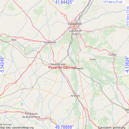
Pozal de Gallinas GPS coordinates[2]
41° 19' 5.916" North, 4° 50' 21.696" West
| Map corner | latitude | longitude |
|---|---|---|
| Upper-left | 41.84425°, | -5.54249° |
| Center: | 41.31831°, | -4.83936° |
| Lower-right: | 40.78809°, | -4.13624° |
| Map W x H: | 117.4×117.4 km | = 72.9×72.9mi |
| max Lat: | 43.74134° ⇑44.3% North |
| Pozal de Gallinas: | 41.31831° |
| min Lat: | ⇓55.7% South 27.64134° |
| min Long | Pozal de Gallin | max Long |
| -18.00367° | -4.83936° | 4.2899° |
| W 29.8%⇐ | ⇒70.2% E |
Elevation
Elevation of Pozal de Gallinas is 732 m = 2402 ft, and this is 134 m = 440 ft above average elevation for this country.
| Max E: |
1682 m = 5518 ft | 41.6% |
| Pozal de Gallinas | 732 m 2402 ft | |
| Avg. | 598 m = 1962 ft | |
Min E: |
0 m = 0 ft | 58.4% |
See also: Spain elevation on elevation.city.
Geographical zone
Pozal de Gallinas is located in North temperate zone (between Tropic of Cancer and the Arctic Circle). Distance of this Northern Tropic circle is 1988.2 km =1235.4 mi to South.| Distance of | km | miles | from Pozal de Gallinas |
|---|---|---|---|
| North Pole | 5412.9 | 3363.4 | to North |
| Arctic Circle | 2807 | 1744.2 | to North |
| Tropic Cancer | 1988.2 | 1235.4 | to South |
| Equator | 4594.2 | 2854.7 | to South |


Nearby cities:
15 places around Pozal de Gallinas: (largest is in red/bold)
• Alcazarén
15.1 km =9.4 mi,  67°
67°
• Ataquines
15.4 km =9.6 mi,  168°
168°
• La Seca
12 km =7.5 mi,  332°
332°
• Matapozuelos
11.4 km =7.1 mi,  20°
20°
• Medina del Campo
6.3 km =3.9 mi,  263°
263°
• Moraleja de las Panaderas
4.8 km =3 mi, 165°
• Olmedo
13 km =8.1 mi,  105°
105°
• Ramiro
10.9 km =6.8 mi,  155°
155°
• Rubí de Bracamonte
13.6 km =8.5 mi,  211°
211°
• Rueda
14.4 km =8.9 mi,  316°
316°
• San Vicente del Palacio
11.1 km =6.9 mi,  185°
185°
• Serrada
15.6 km =9.7 mi,  352°
352°
• Velascálvaro
14.8 km =9.2 mi,  228°
228°
• Ventosa de la Cuesta
10.4 km =6.5 mi,  4°
4°
• Villaverde de Medina
15.7 km =9.8 mi,  265°
265°
Sources, notices
• [Note1] Compared only with cities in Spain existing in our database
• [Src1] Map data: © OpenStreetMap contributors (CC-BY-SA)
• [Src2] Other city data from geonames.org with taken over terms of usage.
• [Src3] Geographical zone / Annual Mean Temperature by Robert A. Rohde @ Wikipedia
