San Vicente del Palacio geodata
San Vicente del Palacio (Castille and León) is a seat of a third-order administrative division; located in Spain in Europe/Madrid (GMT+2) time zone. With population of 232 people, there are 4847 cities with bigger population in this country. Compared to other cities in Spain, 53.7% of cities are located further ↓South; 70.5% of cities are located further →East and 60.3% of cities have lower elevation than San Vicente del Palacio. Note1
Administrative division(s):
- Level 1: Castille and León
- Level 2: Provincia de Valladolid
- Level 3: San Vicente del Palacio
Current local time in San Vicente del Palacio:
10:46 PM, ThursdayDifference from your time zone: hours


San Vicente del Palacio GPS coordinates[2]
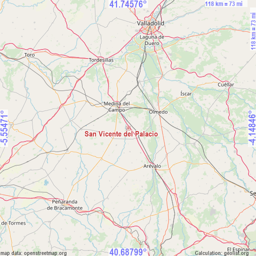
41° 13' 8.436" North, 4° 51' 5.688" West
| Map corner | latitude | longitude |
|---|---|---|
| Upper-left | 41.74576°, | -5.55471° |
| Center: | 41.21901°, | -4.85158° |
| Lower-right: | 40.68799°, | -4.14846° |
| Map W x H: | 117.6×117.6 km | = 73.1×73.1mi |
| max Lat: | 43.74134° ⇑46.3% North |
| San Vicente del Palacio: | 41.21901° |
| min Lat: | ⇓53.7% South 27.64134° |
| min Long | San Vicente del | max Long |
| -18.00367° | -4.85158° | 4.2899° |
| W 29.5%⇐ | ⇒70.5% E |
Elevation
Elevation of San Vicente del Palacio is 747 m = 2451 ft, and this is 149 m = 489 ft above average elevation for this country.
| Max E: |
1682 m = 5518 ft | 39.7% |
| San Vicente del Palacio | 747 m 2451 ft | |
| Avg. | 598 m = 1962 ft | |
Min E: |
0 m = 0 ft | 60.3% |
See also: Spain elevation on elevation.city.
Geographical zone
San Vicente del Palacio is located in North temperate zone (between Tropic of Cancer and the Arctic Circle). Distance of this Northern Tropic circle is 1977.2 km =1228.6 mi to South.| Distance of | km | miles | from San Vicente del Palacio |
|---|---|---|---|
| North Pole | 5423.9 | 3370.3 | to North |
| Arctic Circle | 2818 | 1751 | to North |
| Tropic Cancer | 1977.2 | 1228.6 | to South |
| Equator | 4583.1 | 2847.8 | to South |


Nearby cities:
15 places around San Vicente del Palacio: (largest is in red/bold)
• Almenara de Adaja
14.5 km =9 mi,  92°
92°
• Ataquines
5.7 km =3.5 mi,  135°
135°
• Bobadilla del Campo
14.4 km =8.9 mi,  263°
263°
• Bocigas
14.3 km =8.9 mi,  84°
84°
• Cervillego de la Cruz
8.9 km =5.5 mi,  247°
247°
• Fuente el Sol
8.4 km =5.2 mi,  235°
235°
• Medina del Campo
11.6 km =7.2 mi,  333°
333°
• Moraleja de las Panaderas
6.7 km =4.2 mi,  19°
19°
• Palacios de Goda
12.5 km =7.8 mi,  153°
153°
• Pozal de Gallinas
11.1 km =6.9 mi,  5°
5°
• Ramiro
5.6 km =3.5 mi, 79°
• Rubí de Bracamonte
6.2 km =3.9 mi,  265°
265°
• Salvador de Zapardiel
11.5 km =7.1 mi,  189°
189°
• San Pablo de la Moraleja
8.9 km =5.5 mi, 136°
• Velascálvaro
10.2 km =6.3 mi,  277°
277°
Sources, notices
• [Note1] Compared only with cities in Spain existing in our database
• [Src1] Map data: © OpenStreetMap contributors (CC-BY-SA)
• [Src2] Other city data from geonames.org with taken over terms of usage.
• [Src3] Geographical zone / Annual Mean Temperature by Robert A. Rohde @ Wikipedia
