Nava del Rey geodata
Nava del Rey (Castille and León) is a seat of a third-order administrative division; located in Spain in Europe/Madrid (GMT+2) time zone. With population of 2,110 people, there are 2096 cities with bigger population in this country. Compared to other cities in Spain, 55.9% of cities are located further ↓South; 73.5% of cities are located further →East and 61% of cities have lower elevation than Nava del Rey. Note1
Administrative division(s):
- Level 1: Castille and León
- Level 2: Provincia de Valladolid
- Level 3: Nava del Rey


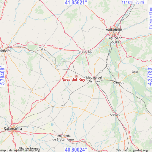
Nava del Rey GPS coordinates[2]
41° 19' 49.296" North, 5° 4' 51.42" West
| Map corner | latitude | longitude |
|---|---|---|
| Upper-left | 41.85621°, | -5.78408° |
| Center: | 41.33036°, | -5.08095° |
| Lower-right: | 40.80024°, | -4.37783° |
| Map W x H: | 117.4×117.4 km | = 72.9×72.9mi |
| max Lat: | 43.74134° ⇑44.1% North |
| Nava del Rey: | 41.33036° |
| min Lat: | ⇓55.9% South 27.64134° |
| min Long | Nava del Rey | max Long |
| -18.00367° | -5.08095° | 4.2899° |
| W 26.5%⇐ | ⇒73.5% E |
Elevation
Elevation of Nava del Rey is 751 m = 2464 ft, and this is 153 m = 502 ft above average elevation for this country.
| Max E: |
1682 m = 5518 ft | 39% |
| Nava del Rey | 751 m 2464 ft | |
| Avg. | 598 m = 1962 ft | |
Min E: |
0 m = 0 ft | 61% |
See also: Spain elevation on elevation.city.
Geographical zone
Nava del Rey is located in North temperate zone (between Tropic of Cancer and the Arctic Circle). Distance of this Northern Tropic circle is 1989.6 km =1236.3 mi to South.| Distance of | km | miles | from Nava del Rey |
|---|---|---|---|
| North Pole | 5411.6 | 3362.6 | to North |
| Arctic Circle | 2805.7 | 1743.4 | to North |
| Tropic Cancer | 1989.6 | 1236.3 | to South |
| Equator | 4595.5 | 2855.5 | to South |


Nearby cities:
15 places around Nava del Rey: (largest is in red/bold)
• Alaejos
11.5 km =7.1 mi,  257°
257°
• Bobadilla del Campo
14.8 km =9.2 mi,  160°
160°
• Carpio
13.2 km =8.2 mi,  190°
190°
• Castronuño
16.6 km =10.3 mi,  293°
293°
• Fresno El Viejo
15.7 km =9.8 mi,  199°
199°
• La Seca
17.3 km =10.7 mi,  57°
57°
• Medina del Campo
14.1 km =8.8 mi,  98°
98°
• Nueva Villa de las Torres
7.3 km =4.5 mi, 163°
• Pollos
13.2 km =8.2 mi,  343°
343°
• Rueda
13.7 km =8.5 mi,  48°
48°
• Siete Iglesias de Trabancos
9 km =5.6 mi, 285°
• Torrecilla de la Abadesa
17.2 km =10.7 mi,  358°
358°
• Torrecilla de la Orden
17.2 km =10.7 mi,  223°
223°
• Velascálvaro
14.4 km =8.9 mi,  140°
140°
• Villaverde de Medina
5.3 km =3.3 mi,  119°
119°
Sources, notices
• [Note1] Compared only with cities in Spain existing in our database
• [Src1] Map data: © OpenStreetMap contributors (CC-BY-SA)
• [Src2] Other city data from geonames.org with taken over terms of usage.
• [Src3] Geographical zone / Annual Mean Temperature by Robert A. Rohde @ Wikipedia
