Valdelacasa geodata
Valdelacasa (Castille and León) is a seat of a third-order administrative division; located in Spain in Europe/Madrid (GMT+2) time zone. With population of 317 people, there are 4431 cities with bigger population in this country. Compared to other cities in Spain, 61.7% of cities are located further ↑North; 82.8% of cities are located further →East and 85.4% of cities have lower elevation than Valdelacasa. Note1
Administrative division(s):
- Level 1: Castille and León
- Level 2: Provincia de Salamanca
- Level 3: Valdelacasa


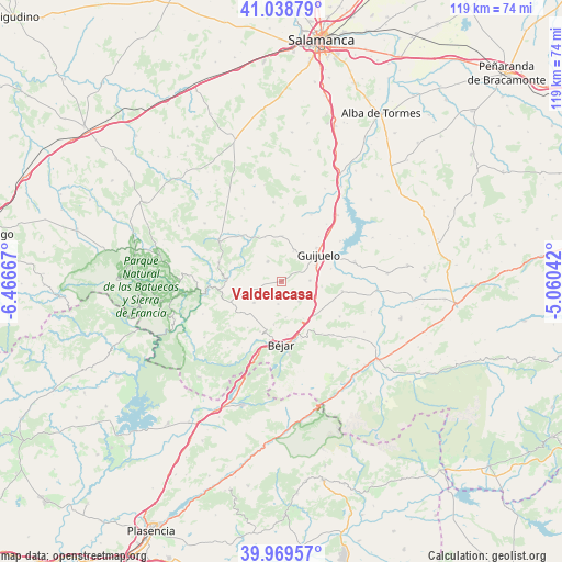
Valdelacasa GPS coordinates[2]
40° 30' 22.716" North, 5° 45' 48.744" West
| Map corner | latitude | longitude |
|---|---|---|
| Upper-left | 41.03879°, | -6.46667° |
| Center: | 40.50631°, | -5.76354° |
| Lower-right: | 39.96957°, | -5.06042° |
| Map W x H: | 118.9×118.9 km | = 73.9×73.9mi |
| max Lat: | 43.74134° ⇑61.7% North |
| Valdelacasa: | 40.50631° |
| min Lat: | ⇓38.3% South 27.64134° |
| min Long | Valdelacasa | max Long |
| -18.00367° | -5.76354° | 4.2899° |
| W 17.2%⇐ | ⇒82.8% E |
Elevation
Elevation of Valdelacasa is 956 m = 3136 ft, and this is 358 m = 1175 ft above average elevation for this country.
| Max E: |
1682 m = 5518 ft | 14.6% |
| Valdelacasa | 956 m 3136 ft | |
| Avg. | 598 m = 1962 ft | |
Min E: |
0 m = 0 ft | 85.4% |
See also: Spain elevation on elevation.city.
Geographical zone
Valdelacasa is located in North temperate zone (between Tropic of Cancer and the Arctic Circle). Distance of this Northern Tropic circle is 1898 km =1179.4 mi to South.| Distance of | km | miles | from Valdelacasa |
|---|---|---|---|
| North Pole | 5503.2 | 3419.5 | to North |
| Arctic Circle | 2897.3 | 1800.3 | to North |
| Tropic Cancer | 1898 | 1179.4 | to South |
| Equator | 4503.9 | 2798.6 | to South |


Nearby cities:
15 places around Valdelacasa: (largest is in red/bold)
• Casafranca
9.6 km =6 mi,  1°
1°
• Fresnedoso
9 km =5.6 mi,  149°
149°
• Fuenterroble de Salvatierra
7 km =4.3 mi,  21°
21°
• Fuentes de Béjar
6 km =3.7 mi,  88°
88°
• Guijuelo
9.7 km =6 mi,  54°
54°
• Ledrada
5.5 km =3.4 mi,  138°
138°
• Los Santos
5.1 km =3.2 mi,  325°
325°
• Nava de Béjar
8 km =5 mi,  115°
115°
• Navalmoral de Béjar
9.4 km =5.8 mi,  190°
190°
• Peromingo
4.8 km =3 mi, 189°
• Puebla de San Medel
2.3 km =1.4 mi,  77°
77°
• Sanchotello
7.6 km =4.7 mi,  173°
173°
• Sorihuela
10 km =6.2 mi,  133°
133°
• Valdefuentes de Sangusín
7.4 km =4.6 mi,  232°
232°
• Valverde de Valdelacasa
3.1 km =1.9 mi,  208°
208°
Sources, notices
• [Note1] Compared only with cities in Spain existing in our database
• [Src1] Map data: © OpenStreetMap contributors (CC-BY-SA)
• [Src2] Other city data from geonames.org with taken over terms of usage.
• [Src3] Geographical zone / Annual Mean Temperature by Robert A. Rohde @ Wikipedia
