Peromingo geodata
Peromingo (Castille and León) is a seat of a third-order administrative division; located in Spain in Europe/Madrid (GMT+2) time zone. With population of 145 people, there are 5463 cities with bigger population in this country. Compared to other cities in Spain, 62.6% of cities are located further ↑North; 82.9% of cities are located further →East and 67% of cities have lower elevation than Peromingo. Note1
Administrative division(s):
- Level 1: Castille and León
- Level 2: Provincia de Salamanca
- Level 3: Peromingo


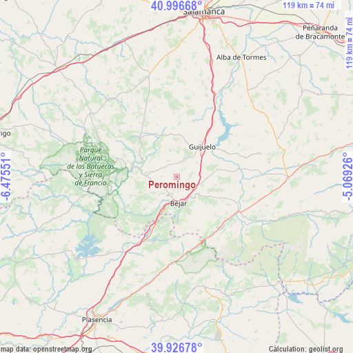
Peromingo GPS coordinates[2]
40° 27' 49.896" North, 5° 46' 20.568" West
| Map corner | latitude | longitude |
|---|---|---|
| Upper-left | 40.99668°, | -6.47551° |
| Center: | 40.46386°, | -5.77238° |
| Lower-right: | 39.92678°, | -5.06926° |
| Map W x H: | 119×119 km | = 73.9×73.9mi |
| max Lat: | 43.74134° ⇑62.6% North |
| Peromingo: | 40.46386° |
| min Lat: | ⇓37.4% South 27.64134° |
| min Long | Peromingo | max Long |
| -18.00367° | -5.77238° | 4.2899° |
| W 17.1%⇐ | ⇒82.9% E |
Elevation
Elevation of Peromingo is 792 m = 2598 ft, and this is 194 m = 636 ft above average elevation for this country.
| Max E: |
1682 m = 5518 ft | 33% |
| Peromingo | 792 m 2598 ft | |
| Avg. | 598 m = 1962 ft | |
Min E: |
0 m = 0 ft | 67% |
See also: Spain elevation on elevation.city.
Geographical zone
Peromingo is located in North temperate zone (between Tropic of Cancer and the Arctic Circle). Distance of this Northern Tropic circle is 1893.2 km =1176.4 mi to South.| Distance of | km | miles | from Peromingo |
|---|---|---|---|
| North Pole | 5507.9 | 3422.4 | to North |
| Arctic Circle | 2902 | 1803.2 | to North |
| Tropic Cancer | 1893.2 | 1176.4 | to South |
| Equator | 4499.2 | 2795.7 | to South |


Nearby cities:
15 places around Peromingo: (largest is in red/bold)
• Béjar
8.6 km =5.3 mi,  174°
174°
• Fresnedoso
6.1 km =3.8 mi,  120°
120°
• Fuentes de Béjar
8.3 km =5.2 mi,  53°
53°
• Ledrada
4.4 km =2.7 mi,  82°
82°
• Nava de Béjar
8 km =5 mi, 80°
• Navacarros
8.8 km =5.5 mi,  146°
146°
• Navalmoral de Béjar
4.7 km =2.9 mi,  191°
191°
• Puebla de San Medel
6 km =3.7 mi,  30°
30°
• Sanchotello
3.3 km =2.1 mi, 151°
• Sorihuela
8.3 km =5.2 mi,  105°
105°
• Valdefuentes de Sangusín
5.1 km =3.2 mi,  272°
272°
• Valdehijaderos
8.1 km =5 mi,  232°
232°
• Valdelacasa
4.8 km =3 mi,  9°
9°
• Vallejera de Riofrío
7.6 km =4.7 mi,  143°
143°
• Valverde de Valdelacasa
2.1 km =1.3 mi,  338°
338°
Sources, notices
• [Note1] Compared only with cities in Spain existing in our database
• [Src1] Map data: © OpenStreetMap contributors (CC-BY-SA)
• [Src2] Other city data from geonames.org with taken over terms of usage.
• [Src3] Geographical zone / Annual Mean Temperature by Robert A. Rohde @ Wikipedia
